 Kielce: Kielce Market Square
Built around the estates of Kraków’s bishops, Kielce grew into the capital of Poland’s Holy Cross Voivodeship. Its Market Square is the civic heart of a city on the northern edge of the Świętokrzyskie Mountains, one of Poland’s oldest mountain ranges. The square belongs to Kielce’s medieval core, while the nearby former Palace of the Kraków Bishops, erected in the 17th century, recalls the ecclesiastical authority that shaped the town for centuries. Streets leading from the open plaza link cafés, shops and public institutions with the wider centre. Kielce is also an urban base for exploring the Świętokrzyskie region, where low wooded ridges and long-settled towns define the landscape.
Generated by AI
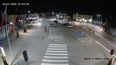




Kielce is best known within Poland for Kadzielnia, a former limestone quarry preserved as a nature reserve in the city. Set in the foothills of the Świętokrzyskie Mountains, the regional capital is crossed by the Silnica River and has long been associated with the area’s distinctive geology. Kadzielnia’s exposed rock faces and cave system give this urban park an unusual geological character; its amphitheatre also hosts concerts and public events. The 17th-century Palace of the Kraków Bishops, now home to the National Museum in Kielce, recalls the city’s ties to the bishops of Kraków. Find related webcams in the surrounding area to build a fuller picture of Kielce and the Świętokrzyskie region.
1 webcam
The terrain of Holy Cross Voivodeship ranges from the forested Świętokrzyskie Mountains in its north-central belt to the limestone hills and river valleys of the Nida Basin in the south, giving the region a compact but varied inland character. Łysica, at 614 metres, is the highest point of the Świętokrzyskie Mountains, while the Nida flows through a quieter agricultural district. Kielce, the voivodeship capital, is home to the 17th-century Palace of the Kraków Bishops. The Holy Cross monastery on Łysa Góra gave the region its name and remains a defining spiritual landmark. Continue with other webcams from the area to see how this part of south-central Poland connects regionally.
20 webcams
Poland stretches from the Baltic Sea coast in the north to the Carpathian Mountains along its southern frontier, encompassing broad lowlands, lake districts and upland ranges. The Vistula, the country’s longest river, links Kraków and Warsaw before reaching the Baltic near Gdańsk, while the Masurian Lake District is defined by a dense network of lakes. Kraków’s historic centre, including Wawel Castle, recalls Poland’s former royal capital; Warsaw’s rebuilt Old Town speaks to the city’s recovery after the Second World War. The Białowieża Forest preserves one of Europe’s last primeval lowland forests and is home to European bison. Follow how Poland’s regions relate to one another by browsing webcams across the country.
711 webcams