 Fire Island: Cherry Grove - Dock Walk
Cherry Grove has served as an LGBTQ retreat on Fire Island since the 1930s. Set on the narrow barrier island between the Atlantic Ocean and Great South Bay, this small, car-free community is organized around sandy lanes and raised wooden walks. Dock Walk is one of the pedestrian routes tying homes, guesthouses and the ferry landing together. Cherry Grove helped establish Fire Island as an important summer refuge for LGBTQ New Yorkers; its social life and independent character remain central to its identity. Fire Island National Seashore protects much of the island’s ocean shore, dunes and maritime forest, placing the settled enclave within a wider coastal setting.
Generated by AI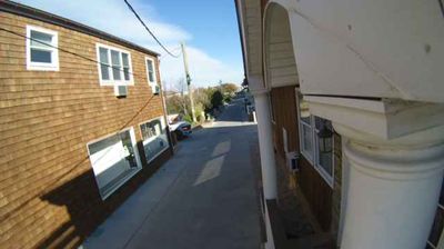



Fire Island has served as a summer retreat on Long Island’s south shore since the late 19th century. This narrow barrier island separates Great South Bay from the Atlantic Ocean, with sandy beaches, dunes and maritime forest shaping a landscape that changes with the seasons and storms. Much of its length belongs to Fire Island National Seashore, created in 1964 to protect the coast and its communities. The 1858 Fire Island Lighthouse remains a landmark at the island’s western end, while many settlements retain a deliberately car-free rhythm. Move on to other webcams in New York to compare coastal landscapes and settings around Fire Island.
1 webcam
New York has served as a commercial and transport heartland within the United States since the early 19th century. These coordinates lie in Central New York, near Oneida Lake, the largest lake entirely within the state. The lake and the nearby Mohawk Valley formed part of the wider corridor that made the Erie Canal, completed in 1825, a decisive link between the Hudson River and the Great Lakes. This is also part of the ancestral homeland of the Oneida people, one of the Haudenosaunee nations. Today, waterways, small lakeside communities and the canal-era landscape give the area a distinctly inland New York character. Explore nearby webcam locations that provide complementary perspectives on Central New York and Oneida Lake.
65 webcams
The Atlantic, Pacific and Gulf coasts define much of the United States — their ports, fisheries and trade routes have long tied the country’s economy to the wider world. Between them, the Rocky Mountains, Great Plains and Mississippi River basin form sharply different regions, from high western ranges to broad agricultural heartlands. Cities carry much of the national story: New York’s Statue of Liberty, a gift from France dedicated in 1886, remains an enduring symbol, while Washington, DC concentrates major federal institutions. Indigenous nations have shaped these lands for millennia, and their living cultures remain essential to the country’s identity. Find related webcams in the surrounding areas to build a fuller picture of the United States.
32K webcams