 Hof: Lómagnúpur
Tucked between the Skeiðarársandur outwash plain and the highlands of southeast Iceland, Lómagnúpur is a place whose character is shaped by the abrupt rise of a palagonite mountain from low, water-laid terrain. Reaching 767 metres, it is a commanding landmark on Iceland’s south coast, with dark layered slopes that mark a sharp transition from sandur to upland. The mountain stands near the Ring Road, the national highway whose completion in 1974 made a continuous road journey around Iceland possible. Skeiðarársandur was formed by glacial rivers draining Vatnajökull, connecting this remote part of the Southern Region with Iceland’s largest ice cap and Vatnajökull National Park farther east.
Generated by AI
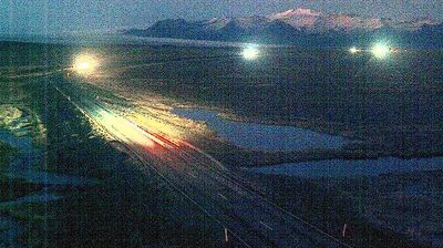

Among the settlements of Iceland’s Southern Region, Hof stands out for Hofskirkja, a preserved turf church beneath the glacial landscapes of Vatnajökull. Built in 1884, the church is among Iceland’s surviving examples of the traditional construction style, with turf walls and a grass-covered roof. Hof belongs to Öræfi, a sparsely settled district between the ice fields of Vatnajökull and Iceland’s southeast coast, where glacial rivers and outwash plains have long shaped the land. Nearby Vatnajökull National Park places the settlement within one of the country’s most dramatic volcanic and glacial regions. Browse other webcams across Öræfi and the Southern Region to place Hof in a wider geographic context.
2 webcams
Iceland’s Southern Region extends from the Atlantic coast to the Vatnajökull ice cap, encompassing black-sand shores, glacial outwash plains and volcanic highlands. This broad part of the country is crossed by rivers descending from the interior, including the Þjórsá, Iceland’s longest river. Vatnajökull National Park protects extensive glacier and volcanic terrain, while the south coast bears the marks of eruptions, floods and ocean weather. Þingvellir, a UNESCO World Heritage Site, is where the Alþingi, Iceland’s parliament, first assembled in 930. Farms and small towns lie between mountains and sea, in a region where conditions can change rapidly. Continue through nearby webcams to explore different parts of Iceland’s Southern Region.
104 webcams
Iceland occupies a volcanic North Atlantic island on the Mid-Atlantic Ridge, between Europe and North America. Glaciers, black-sand shores and active geothermal areas form a terrain in constant dialogue with the weather; Vatnajökull is Europe’s largest glacier by volume. The Golden Circle links Þingvellir National Park, the Geysir geothermal area and Gullfoss waterfall, while Reykjavík concentrates much of the country’s contemporary culture and design. At Þingvellir, the Alþingi first assembled in 930. Fishing, wool knitwear and geothermal energy remain central to Icelandic life. Find related webcams in the surrounding area to build a fuller picture of Iceland.
652 webcams