 Saint Vith
The landscape around Recht is forested and gently rolling, which has shaped both the built environment and local life. This small settlement belongs to the municipality of St. Vith in Belgium’s German-speaking Community, close to the borders with Germany and Luxembourg. It lies in the Belgian Eifel, where conifer woods and pastureland form part of the wider Ardennes uplands. The area is crossed by the Vennbahn, a former railway line now used as a long-distance cycling route through Belgium, Germany and Luxembourg. St. Vith, the municipal centre, was heavily destroyed during the Battle of the Bulge in the winter of 1944–45; its rebuilt townscape and rural outlying villages reflect a borderland shaped by changing European frontiers.
Generated by AI




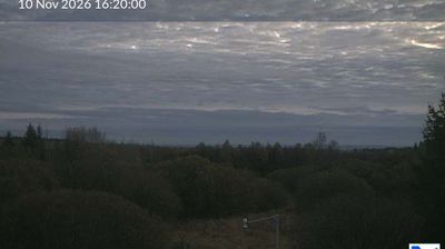


Saint Vith combines a compact town centre with the open, wooded uplands of the Eifel in a way that reflects its borderland position in eastern Belgium. The Braunlauf runs through the town before joining the Our, linking Saint Vith to the river valleys of the Belgian Eifel. It belongs to Belgium’s German-speaking Community, so German is heard alongside the wider Walloon setting. Once an important rail junction, Saint Vith became a hard-fought objective during the Battle of the Bulge in 1944 and was severely damaged. Today, the former Vennbahn railway corridor forms part of a long-distance cycling route. Move on to other webcams in eastern Belgium to compare landscapes and settings around the Eifel.
1 webcam
Among Belgium’s regions, Wallonia stands out for its French-speaking identity and the Meuse and Sambre valleys that helped shape the country’s industrial age. The Meuse runs through a chain of historic towns, including Namur, where the Sambre joins it beneath the city’s citadel, and Dinant, the birthplace of saxophone inventor Adolphe Sax. South and east, the terrain rises into the Ardennes, with forests, river valleys and smaller settlements replacing the denser urban belt. Wallonia’s towns still reflect long traditions of mining, metalworking and river trade, while abbey brewing remains part of the regional culture. Browse additional webcams from the surrounding area to extend your view of Wallonia.
47 webcams
Belgium occupies a low-lying North Sea coastline and river plain in northwestern Europe. Dutch-speaking Flanders lies largely to the north, while French-speaking Wallonia reaches south towards the wooded Ardennes; Brussels is officially bilingual. The Scheldt and Meuse have long connected Belgian cities with the North Sea and continental Europe. Brussels’ Grand-Place, framed by ornate guildhalls and the Town Hall, is a UNESCO World Heritage site. Medieval Bruges retains canals and merchant architecture, while Antwerp remains a major port on the Scheldt. Belgian beer culture is recognised by UNESCO as intangible cultural heritage. See how Belgium connects with the North Sea coast and neighbouring regions by browsing webcams nearby.
99 webcams