 Piękna Góra: Kisajno, Port Sailor
Built along the shore of Lake Kisajno, Piękna Góra grew into a small waterside settlement on the Great Masurian Lakes. Kisajno belongs to the interconnected lake system around Giżycko, where channels and broad waters have long made boating central to local life. Reedy margins, wooded banks and a low, open shoreline give the area a quieter character than an urban waterfront, while moorings and small ports underline its practical role for sailing. The lake lies close to Giżycko, the main service town of the district, known for the 19th-century Boyen Fortress. Piękna Góra suits travellers seeking the everyday geography of Masuria: water routes, marina infrastructure and a shoreline shaped by lakeside recreation rather than monumental development.
Generated by AI



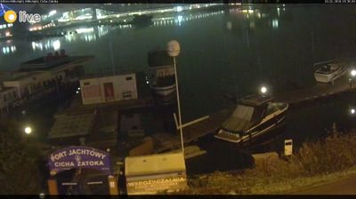


Piękna Góra lies on the western shore of Lake Kisajno, where wooded islands, reed-fringed water and connecting channels form part of Poland’s Great Masurian Lakes. This small settlement sits west of Giżycko, a major sailing centre whose lakes are linked by navigable waterways. Lake Kisajno belongs to a broad route through the Masurian lake district, familiar to cruising boats as well as paddlers. In nearby Giżycko, the 19th-century Boyen Fortress recalls the former Prussian military presence in Masuria; its brick ramparts are among the town’s principal historic sites. Piękna Góra helps show how water, woodland and settlements meet in this northeastern corner of Poland. Move on to other webcams in Warmian-Masurian Voivodeship to compare lakeside settings around Piękna Góra.
1 webcam
Warmian-Masurian Voivodeship combines tranquil lake country with the urban heritage of Warmia in a way that reflects its position between Warmia and Masuria in northeastern Poland. The Great Masurian Lakes form the region’s best-known water network, with Lake Śniardwy the largest lake in Poland. Forests, farmland and waterways spread across a borderland shaped by Polish, German and Prussian histories. In Olsztyn, the former castle of the Warmian chapter is associated with Nicolaus Copernicus, who administered its estates. The regional capital is also a useful starting point for journeys through the lake district and its smaller towns. Browse additional webcams from the surrounding area to extend your view of Warmia and Masuria.
30 webcams
Poland stretches from the Baltic Sea coast in the north to the Carpathian Mountains along its southern frontier, encompassing broad lowlands, lake districts and upland ranges. The Vistula, the country’s longest river, links Kraków and Warsaw before reaching the Baltic near Gdańsk, while the Masurian Lake District is defined by a dense network of lakes. Kraków’s historic centre, including Wawel Castle, recalls Poland’s former royal capital; Warsaw’s rebuilt Old Town speaks to the city’s recovery after the Second World War. The Białowieża Forest preserves one of Europe’s last primeval lowland forests and is home to European bison. Follow how Poland’s regions relate to one another by browsing webcams across the country.
718 webcams