 Puzi City: 台19線
The landscape around Puzi City is low, level farmland on the Chianan Plain, which has shaped both the built environment and local life. Puzi stands in Chiayi County in western Taiwan, where a grid of irrigation channels, fields and expanding urban districts reflects the plain’s long agricultural use. Provincial Highway 19 is a major north–south road through this part of the island, linking Changhua in central Taiwan with Yongkang in Tainan. Near Puzi it meets the east–west Provincial Highway 82, a controlled-access route across Chiayi County. This road junction places the city within the wider transport network between coastal districts and Chiayi’s inland communities. Street-front businesses, local services and housing concentrate around the main corridors, while the surrounding plain remains closely tied to farming.
Generated by AI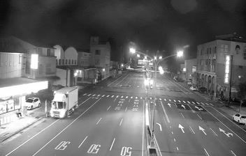


The flat, cultivated alluvial land around Puzi City forms part of Taiwan’s Chianan Plain, which has shaped both its low-rise urban fabric and local agricultural economy. Puzi lies in Chiayi County on the island’s west side, where the Taiwan Strait is approached across broad coastal lowlands rather than mountain passes. The city is closely associated with Peitian Temple, a major Mazu shrine whose religious life reflects the enduring place of Taiwanese folk belief in community calendars. Its streets provide a practical base for discovering the farming districts of the plain and nearby coastal county. Move on to other webcams in Chiayi County to compare agricultural and coastal settings around Puzi.
1 webcam
Chiayi County occupies a coastal plain and rising foothills in western Taiwan. Its terrain runs from agricultural lowlands facing the Taiwan Strait toward the Alishan Mountains, where cooler high-country landscapes contrast with the humid plains. The Bazhang River crosses the county on its course to the coast. Chiayi is closely associated with Alishan tea and the Alishan Forest Railway, a historic narrow-gauge line built during the Japanese colonial period that still links the lowlands with mountain country. In Taibao, the Southern Branch of the National Palace Museum presents Asian art and cultural collections. Explore nearby webcam locations that provide complementary perspectives on Chiayi County.
2 webcams
Taiwan's terrain ranges from fertile plains along the western coast to steep mountains in the interior, concentrating much of its population on the lowlands. The Central Mountain Range runs through the island, while the Pacific meets a more rugged eastern shoreline and the Taiwan Strait lies to the west. Taipei combines contemporary city life with major cultural institutions: the National Palace Museum preserves an extensive collection of Chinese imperial art. Across Taiwan, night markets are central to everyday eating, serving regional snacks alongside familiar staples. Tea cultivation, especially in upland areas, remains an enduring part of the island's food culture. Explore nearby locations that provide complementary perspectives on Taiwan.
95 webcams