 Tauranga: Tauranga Airport
Tauranga Airport combines the practical scale of a regional airfield with a setting close to Tauranga Harbour in a way that reflects its coastal position in the Bay of Plenty. Its runway, aprons and hangars serve Tauranga and the communities around Mount Maunganui, linking the area with New Zealand’s domestic air network. The airport occupies low, open land between the harbour and the Pacific coast. Mauao, the extinct volcanic cone at the harbour entrance, is one of Tauranga’s defining landmarks and holds deep cultural significance for local Māori. Tauranga is an important Bay of Plenty centre, with its sheltered harbour continuing to shape commerce and urban development.
Generated by AI
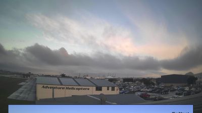


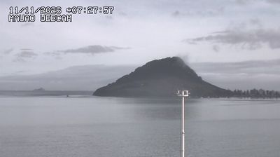

Tauranga’s setting is a low coastal plain around Tauranga Harbour, and it has shaped both the city’s layout and its working economy. The sheltered waterway supports the Port of Tauranga, a major hub for container, forestry and bulk cargo, while waterfront precincts bring the centre close to the harbour. At the entrance stands Mauao, the extinct volcanic cone also known as Mount Maunganui and a place of deep significance to local Māori. The Elms | Te Papa Tauranga preserves a mission house and gardens that recall the nineteenth-century colonial period. Pacific beaches add another dimension to a city defined by sea routes and coastal living. Browse additional webcams nearby to see how Tauranga Harbour and the Bay of Plenty fit into the wider coast.
7 webcams
Developing around fertile volcanic soils and Pacific coastal trade, the Bay of Plenty has become one of New Zealand’s leading horticultural and seaside regions. Tauranga Harbour shapes the western part of the bay, with the Kaimai Range rising inland and Mauao standing at the harbour entrance near Mount Maunganui. Kiwifruit orchards are a defining feature around Te Puke, while Tauranga also preserves the Gate Pā Historic Reserve, associated with an important 1864 battle. Māori connections remain central to the area’s identity and place names. Explore nearby webcam locations that provide complementary perspectives on the Bay of Plenty coast and Tauranga Harbour.
12 webcams
New Zealand combines Pacific isolation with strong ties to the wider South Pacific in a way that reflects its position between the Tasman Sea and the open Pacific Ocean. The country’s two main islands are divided by Cook Strait, while the Southern Alps run along much of the South Island and include Aoraki / Mount Cook, its highest mountain. On the North Island, volcanic terrain shapes Tongariro National Park and the central plateau; long coastlines frame cities such as Auckland and Wellington. Māori culture is central to national life, and the Treaty of Waitangi, first signed in 1840, remains a foundational document in relations between Māori and the Crown. See how New Zealand fits within the wider South Pacific by browsing webcams nearby.
448 webcams