 Sovikj: Agios Athanasios
Few places in Central Macedonia have a history as closely tied to Vlach mountain life as Agios Athanasios. Also known as Palaios Agios Athanasios, this stone-built settlement stands at about 1,200 metres on the slopes of Mount Voras, whose Kaimaktsalan summit forms part of the border range between Greece and North Macedonia. Its lanes and houses reflect the local Macedonian building tradition, with stone walls, timber details and red-tiled roofs. The village declined during the 20th century but was revived as a mountain destination, helped by its proximity to the Kaimaktsalan ski centre. It remains a base for exploring the forested Voras massif and the higher terrain around the border.
Generated by AI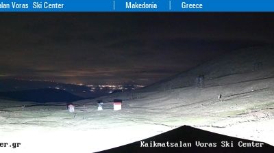




Sovikj has served as a small rural settlement in the Pelagonia region since the modern era. It lies in the wider Pelagonia Basin, North Macedonia’s broad southern interior plain, close to the country’s borderlands with Greece. This is a markedly agricultural part of the country, shaped by open fields, scattered villages and the long-established rhythms of farming communities. Rather than an urban destination, Sovikj represents the quieter, sparsely settled side of Pelagonia. See how Sovikj relates to the wider Pelagonia region by browsing webcams nearby.
1 webcam
Municipality of Novaci has served as a frontier district within North Macedonia’s southern borderlands since the early 20th century. It extends south of Bitola across the Pelagonia plain toward the Greek border, where the Crna River and open farmland give way to the rugged slopes of the Nidže range. Kajmakčalan, on the border ridge, is associated with fighting on the Macedonian Front in the First World War. The municipality also reaches into Mariovo, a sparsely settled upland area whose stone-built settlements and pastoral traditions contrast with the cultivated plain. Continue through nearby webcams to explore different parts of the Municipality of Novaci.
3 webcams
The Vardar River valley defines much of North Macedonia — its route through the country has concentrated farms, roads and major towns between mountain ranges. Lake Ohrid, shared with Albania, gives the southwest a different character: an ancient lake beside the historic city of Ohrid and its UNESCO-listed natural and cultural heritage. Skopje, the capital, combines the Ottoman-era Old Bazaar with newer districts on both sides of the Vardar. Elsewhere, the Šar Mountains, Mavrovo National Park and the Pelister range frame a compact country of highland pastures, forests and agricultural basins. Food traditions draw on Balkan and Mediterranean influences, with peppers, beans and local wines prominent. Move on to other webcams in the region to compare landscapes and settings around North Macedonia.
19 webcams