 Huehuetenango
 combines the energy of a departmental capital with the scale of a highland town in a way that reflects its position beneath the Sierra de los Cuchumatanes in western Guatemala. The city is the administrative centre of Huehuetenango Department, a mountainous region whose communities include Mam, Q'anjob'al, Chuj and Akatek Maya peoples and language traditions. Built-up neighbourhoods and cultivated land meet along the rolling uplands around town, while the Cuchumatanes form the dominant geographic framework farther north. Huehuetenango is also an important commercial stop for surrounding municipalities, giving its streets a practical, regional character.
Generated by AI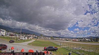

Huehuetenango extends along highland ridges below the Sierra de los Cuchumatanes in western Guatemala, and its mountain position keeps it closely connected to the rural communities of the wider department. As the departmental capital, it is a regional centre where Mam Maya culture remains an important part of local identity. Nearby Zaculeu, the former capital of the Mam Maya, preserves ceremonial plazas, temples and ball courts dating from the pre-Columbian period. The cooler highland climate sets Huehuetenango apart from Guatemala’s tropical lowlands, while routes from town lead towards Chiantla and the Cuchumatanes. See how Huehuetenango fits into western Guatemala by browsing webcams nearby.
2 webcams
The terrain of Huehuetenango ranges from temperate valleys around the departmental capital in the south to the high ridges of the Sierra de los Cuchumatanes farther north, creating marked contrasts in climate and settlement. On Guatemala’s northwestern frontier, the department borders Mexico and is defined by mountain roads, cultivated slopes, and highland towns. Huehuetenango city is its administrative centre, while coffee growing remains important to the local economy. The area is home to Maya peoples including the Mam, Q’anjob’al, Chuj and Akatek, whose languages continue to shape daily life. View additional webcams nearby to better understand how Huehuetenango relates to Guatemala’s northwestern highlands.
2 webcams
Guatemala has served as a crossroads between Mesoamerica’s Pacific and Caribbean corridors since pre-Columbian times. The country brings together the volcanic chain of the Sierra Madre, the broad Pacific lowlands and the forested Petén, where Tikal preserves the temples of one of the great Maya cities. Lake Atitlán lies in the western highlands, encircled by volcanoes and communities where Maya languages and textile traditions remain part of everyday life. In Antigua Guatemala, colonial churches and convents stand amid streets laid out under Spanish rule; the city is a UNESCO World Heritage site. Coffee growing is also central to many highland regions. Find related webcams in the surrounding area to build a fuller picture of Guatemala’s highlands, volcanoes and Maya heartland.
26 webcams