 Witow: Kominiarski Wierch - Chochołowska Valley
Chochołowska Valley is best known in Poland for being the longest valley in the Polish Tatras. Extending through the Western Tatras, it follows the Chochołowski Stream between forested slopes, clearings and high mountain pastures. Kominiarski Wierch, reaching 1,829 metres, is a prominent limestone summit above the valley; its rocky ridges reflect the karst geology characteristic of this part of the range. The valley lies within Tatra National Park and is one of its principal walking corridors, leading to Polana Chochołowska, where a PTTK mountain shelter continues the area’s long pastoral and hiking tradition. It is also a route into the higher Western Tatras rather than an isolated mountain enclave.
Generated by AI

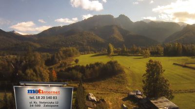





Witów has served as a highland settlement in the Podhale region since the early modern period. Set beside the Czarny Dunajec River in Lesser Poland, it lies between the foothills and the western edge of the Tatra Mountains. The village forms part of a region shaped by Górale traditions, recognised in Poland for its distinctive folk music, regional dress and timber-built houses with steep roofs. Roads and walking routes from Witów lead towards the Tatra National Park and the broad Chochołowska Valley, a popular starting point for mountain excursions. Discover other points of interest through webcams located across Podhale and Lesser Poland.
1 webcam
The Vistula valley and the Carpathian foothills shape much of Lesser Poland Voivodeship, linking Kraków’s metropolitan life with farming districts and mountain tourism along its southern edge. Kraków, Poland’s former royal capital, remains the cultural centre: Wawel Castle and the medieval Old Town stand above the river, within a UNESCO World Heritage-listed historic core. Farther south, the Dunajec cuts through the Pieniny, while the Tatra Mountains form a highland frontier with Slovakia. The Wieliczka Salt Mine, worked from the Middle Ages, recalls the importance of salt to the old Polish state. Move on to other webcams in the region to compare landscapes and settings around Lesser Poland Voivodeship.
82 webcams
Poland stretches from the Baltic Sea coast in the north to the Carpathian Mountains along its southern frontier, encompassing broad lowlands, lake districts and upland ranges. The Vistula, the country’s longest river, links Kraków and Warsaw before reaching the Baltic near Gdańsk, while the Masurian Lake District is defined by a dense network of lakes. Kraków’s historic centre, including Wawel Castle, recalls Poland’s former royal capital; Warsaw’s rebuilt Old Town speaks to the city’s recovery after the Second World War. The Białowieża Forest preserves one of Europe’s last primeval lowland forests and is home to European bison. Follow how Poland’s regions relate to one another by browsing webcams across the country.
711 webcams