 Canas Dulces
Cañas Dulces is best known within Costa Rica for its setting on the lower slopes of Rincón de la Vieja Volcano. This rural community lies in inland Guanacaste, where the volcanic massif rises above a mosaic of pasture, smallholdings and wooded land. Rincón de la Vieja is an active volcano within Rincón de la Vieja National Park, part of the UNESCO-listed Guanacaste Conservation Area. Its protected slopes are associated with geothermal features including fumaroles, mud pots and hot springs. Cattle ranching remains a defining tradition of Guanacaste, and the transition from agricultural lowlands to volcanic uplands gives Cañas Dulces a distinctly regional character.
Generated by AI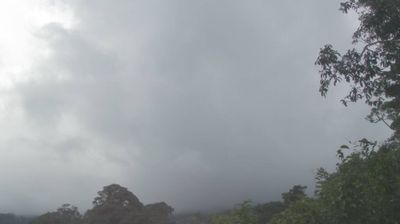

Cañas Dulces sits on the foothills of the Guanacaste Cordillera in northwestern Costa Rica, where the seasonally dry Pacific lowlands rise toward the Rincón de la Vieja volcano. This rural community belongs to Liberia canton, an area shaped by cattle ranching and the sabanero, or cowboy, traditions closely associated with Guanacaste. Rincón de la Vieja National Park protects volcanic terrain, forests and hot springs farther up the cordillera, while the surrounding countryside changes markedly between the dry and rainy seasons. Continue with other webcams from the area to see how this part of Guanacaste connects regionally.
1 webcam
Guanacaste has served as a northwestern frontier within Costa Rica since the nineteenth century. Its identity is closely tied to the former Partido de Nicoya, whose incorporation into Costa Rica is commemorated each 25 July with the Annexation of Nicoya holiday. The province stretches from the Pacific coast and Nicoya Peninsula into the Tempisque River basin and the volcanic highlands around Rincón de la Vieja. A pronounced dry season sets it apart from much of the country, supporting tropical dry forest and cattle-ranching traditions; Liberia is its principal city. Santa Rosa National Park protects extensive dry forest near the northwestern coast. View additional webcams nearby to better understand how Guanacaste relates to its Pacific coast and volcanic interior.
1 webcam
Volcanic mountain ranges, Pacific shores and the Caribbean coast define much of Costa Rica — they support agriculture, tourism and an exceptional variety of ecosystems. Rainforest, cloud forest and dry tropical forest lie within a relatively compact country, while protected areas cover roughly a quarter of its territory. Arenal Volcano is among its best-known natural landmarks, and the Monteverde region is noted for its cloud forest. San José’s National Theatre, opened in 1897, reflects the wealth created by the historic coffee trade. Continue with other webcams from the area to see how this part of Central America connects regionally.
13 webcams