 Mbombela
Kruger National Park occupies the Lowveld of northeastern South Africa, where this section lies in Mpumalanga amid broad bushveld plains. Founded as the Sabie Game Reserve in 1898, it was proclaimed Kruger National Park in 1926 and remains one of Africa’s best-known protected areas. The reserve stretches east of the Drakensberg escarpment towards the Mozambique border, encompassing savanna, river corridors and wooded thickets. The Sabie River is among its principal waterways, supporting important riparian habitat within the park. Roads, rest camps and conservation infrastructure provide access while preserving the vast scale of the wildlife landscape.
Generated by AI
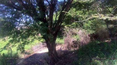

Established beside the Crocodile River on the rail route to Delagoa Bay, Mbombela grew into the capital of South Africa’s Mpumalanga province. Formerly known as Nelspruit, it is a key urban centre of the Lowveld, a subtropical farming region associated with citrus production. The Lowveld National Botanical Garden stands at the confluence of the Crocodile and Nels rivers, preserving plants from several regional habitats. Mbombela Stadium hosted four matches during the 2010 FIFA World Cup, adding a major modern landmark to the city. Discover other points of interest through webcams located across Mpumalanga.
3 webcams
Mpumalanga’s terrain ranges from open Highveld grasslands in the west to the subtropical Lowveld beyond the Drakensberg escarpment in the east, creating marked shifts in climate and vegetation. The escarpment includes the Blyde River Canyon, while the province’s eastern reaches form part of the wider Kruger National Park landscape along the Mozambique border. Forested slopes, farming country and bushveld give the province a varied regional identity. Pilgrim’s Rest, a former gold-mining settlement, recalls the late-19th-century rush that helped shape this part of South Africa. Browse additional webcams from the surrounding area to extend your view of Mpumalanga.
7 webcams
The terrain of South Africa ranges from coastal lowlands along the Indian Ocean in the east to high inland plateaus across the centre, producing marked regional climate contrasts. The Drakensberg forms a rugged eastern escarpment, while Atlantic and Indian Ocean shores frame cities including Cape Town and Durban. Table Mountain stands above Cape Town, and the Cape Floristic Region is internationally noted for its exceptional plant diversity. South Africa’s modern identity is inseparable from apartheid and the democratic transition of 1994, a history explored at Johannesburg’s Apartheid Museum. Twelve official languages reflect the country’s diverse communities. Continue through nearby webcams to explore different parts of South Africa.
61 webcams