 Verviers: Laboru
Laboru combines open agricultural land with a small-scale aviation setting in a way that reflects its position on the rural fringe of Verviers in eastern Wallonia. This locality lies in the wider Vesdre valley, a terrain of fields, hedgerows and scattered settlements between the urban basin of Verviers and the hill country leading towards the Ardennes. Verviers developed as one of Belgium’s important wool and textile centres, with the waters of the Vesdre supporting its industry. Laboru retains a markedly countryside character instead: grassed ground, farm buildings and tree-lined boundaries form a contrast with the denser development around the city. It is a grounded introduction to the working rural surroundings of the Vesdre region and to the modest aviation infrastructure integrated into this agricultural setting.
Generated by AI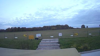







Verviers sits on the Vesdre River in Wallonia, Belgium, where the city follows a narrow valley in the province of Liège. The river’s water long supported wool washing and dyeing, helping Verviers become an important centre of the European wool-textile trade during the 18th and 19th centuries. Former mills and industrial buildings still recall that manufacturing era, while the city’s streets reflect a mix of historic fabric and modern renewal. Verviers also stands within the French-speaking part of eastern Belgium, close to the country’s German-speaking community. Discover other points of interest through webcams located across Verviers and Wallonia.
2 webcams
Among Belgium’s regions, Wallonia stands out for its French-speaking identity and the Meuse and Sambre valleys that helped shape the country’s industrial age. The Meuse runs through a chain of historic towns, including Namur, where the Sambre joins it beneath the city’s citadel, and Dinant, the birthplace of saxophone inventor Adolphe Sax. South and east, the terrain rises into the Ardennes, with forests, river valleys and smaller settlements replacing the denser urban belt. Wallonia’s towns still reflect long traditions of mining, metalworking and river trade, while abbey brewing remains part of the regional culture. Browse additional webcams from the surrounding area to extend your view of Wallonia.
47 webcams
Belgium occupies a low-lying North Sea coastline and river plain in northwestern Europe. Dutch-speaking Flanders lies largely to the north, while French-speaking Wallonia reaches south towards the wooded Ardennes; Brussels is officially bilingual. The Scheldt and Meuse have long connected Belgian cities with the North Sea and continental Europe. Brussels’ Grand-Place, framed by ornate guildhalls and the Town Hall, is a UNESCO World Heritage site. Medieval Bruges retains canals and merchant architecture, while Antwerp remains a major port on the Scheldt. Belgian beer culture is recognised by UNESCO as intangible cultural heritage. See how Belgium connects with the North Sea coast and neighbouring regions by browsing webcams nearby.
99 webcams