 Cipreses: Platanillal: Irazú Volcano - Cartago, Costa Rica
Among the volcanic landscapes of Cartago Province, Irazú Volcano stands out for its broad summit craters and its status as Costa Rica’s highest active volcano. Rising to 3,432 metres in the Cordillera Central, Irazú is a stratovolcano whose upper slopes include steep crater walls, dark volcanic deposits and hardy highland vegetation. Its activity has repeatedly affected the nearby Central Valley; the 1963–65 eruption famously coincided with US President John F. Kennedy’s visit to Costa Rica. The volcano lies within Irazú Volcano National Park, a protected highland area reached from Cartago. Santa Rosa is among the rural communities on the volcano’s slopes, where forest and farmland extend below the summit zone.
Generated by AI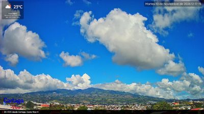




Cipreses occupies elevated agricultural land in Costa Rica’s Cartago Province, on the eastern side of the Central Valley. Fields and small settlements spread across rolling ground south of Irazú Volcano, whose fertile volcanic soils have long supported intensive farming in this highland province. The air is generally cooler here than on the Pacific and Caribbean coasts, a contrast that shapes daily life in Cartago’s interior. Cartago, the provincial capital, served as Costa Rica’s capital until 1823 and remains a major destination for the annual pilgrimage to the Basilica of Our Lady of the Angels. Browse additional webcams from the Cartago highlands to extend your view of Costa Rica’s Central Valley.
1 webcam
The terrain of Cartago Province ranges from volcanic uplands around Irazú and Turrialba in the north to the rugged slopes of the Talamanca Range in the south, creating a land of cool highlands, deep valleys and humid forest. The Reventazón River runs through its eastern interior, while the Turrialba area combines farming communities with one of Costa Rica’s active volcanoes. In Cartago city, the Basílica de Nuestra Señora de los Ángeles is the focus of the annual Romería pilgrimage; the city was Costa Rica’s capital until 1823. Coffee, vegetables and dairy farming remain important across the uplands. Browse more webcams from nearby areas to broaden your perspective on Cartago Province.
2 webcams
Volcanic mountain ranges, Pacific shores and the Caribbean coast define much of Costa Rica — they support agriculture, tourism and an exceptional variety of ecosystems. Rainforest, cloud forest and dry tropical forest lie within a relatively compact country, while protected areas cover roughly a quarter of its territory. Arenal Volcano is among its best-known natural landmarks, and the Monteverde region is noted for its cloud forest. San José’s National Theatre, opened in 1897, reflects the wealth created by the historic coffee trade. Continue with other webcams from the area to see how this part of Central America connects regionally.
13 webcams