 Gustavia: Saint-Barthélemy - Saint-Barthélémy
Saint-Barthélemy straddles the meeting of the Caribbean Sea and Atlantic Ocean in the northern Lesser Antilles, a setting that has shaped a compact volcanic island of steep hills, rocky points and sheltered bays. Its French name is often shortened to St Barts, yet its capital, Gustavia, still reflects nearly a century of Swedish rule: Sweden held the island from 1784 to 1878, and the town was named for King Gustav III. Beyond the port, roads wind between low, dry-tropical slopes and small coastal settlements. Grand Cul-de-Sac, on the northeast shore, is a shallow lagoon edged by a reef, while the wider coastline is central to the island's sailing and beach culture.
Generated by AI
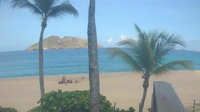


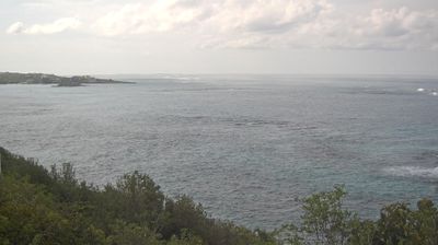


Gustavia occupies a sheltered harbor on Saint Barthélemy’s western coast in the Lesser Antilles. The compact capital of this French Caribbean collectivity faces the Caribbean Sea, with dry, low hills rising immediately behind its waterfront. Sweden governed the island from 1784 to 1878, an era reflected in Gustavia’s name, honoring King Gustav III, and in the remains of Fort Karl and Fort Gustav above the harbor. Today, the port’s quays, boutiques and restaurants remain central to town life, while Shell Beach lies just beyond the center. Browse other webcams across Saint Barthélemy and the Lesser Antilles to place this setting in a wider geographic context.
3 webcams
Saint Barthélemy stretches from the Grand Cul-de-Sac lagoon on its northeastern shore to Gustavia Harbour on the west, encompassing dry volcanic hills, sheltered coves and sandy beaches. Better known as St Barts, this French Caribbean collectivity lies in the Lesser Antilles, southeast of Saint Martin. Small bays break up its rugged coastline, while Grand Cul-de-Sac provides a calmer counterpoint to the open sea. Gustavia retains reminders of Swedish rule from 1784 to 1878; the town was named for King Gustav III. French is the official language, and the island’s character reflects both French and Caribbean traditions. Continue through nearby webcams to explore different parts of Saint Barthélemy.
4 webcams
The Atlantic and Mediterranean coastlines, together with the Alps, Pyrenees and broad river basins, define much of France — they support maritime trade, farming, wine regions and travel throughout the year. The Seine runs through Paris, where the Eiffel Tower and the Louvre are among Europe’s most recognised landmarks. The Loire Valley is known for Renaissance châteaux, while Mont-Saint-Michel rises from a tidal bay in Normandy. Regional food traditions are equally distinctive, from Breton seafood to Provençal cooking, with bread, cheese and wine central to everyday life. France’s global cultural influence is evident in its language, literature, fashion and cinema. View additional webcams nearby to better understand how France’s coasts, plains and mountain borders relate to their surroundings.
2.2K webcams