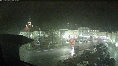
 Letohrad: Václavské Náměstí - Morový sloup - Kostel sv. Václava
Few towns in the Pardubice Region have a history as closely tied to the Kyšperk estate as Letohrad. Its historic core lies in the Tichá Orlice valley, below the Orlické Mountains. Václavské náměstí remains the focal point of the former town of Kyšperk, bringing together arcaded houses, the Church of St Wenceslas and a plague column. The church is a defining feature of the square, while the column belongs to the Baroque tradition of memorials erected in the Czech lands after epidemics. Letohrad adopted its present name in 1950; Kyšperk remains central to the town’s local identity. The nearby river corridor softens the urban setting, but the square retains the compact character of an East Bohemian town.
Generated by AI





Among the towns of the Pardubice Region, Letohrad stands out for its position on the Tichá Orlice River beneath the foothills of the Orlické Mountains. The town developed around the former Kyšperk estate and was known as Kyšperk until its renaming in 1950. Baroque Letohrad Château anchors the historic centre, while its grounds and park add a formal counterpoint to the river valley. Letohrad is also home to the Museum of Crafts, which presents traditional trades in a former granary. The surrounding area links the settled Orlice valley with the wooded uplands of eastern Bohemia. View additional webcams around Letohrad to understand how the Tichá Orlice valley relates to the Orlické Mountains.
1 webcam
Pardubický kraj has been an eastern Bohemian heartland of the Czech lands since the Middle Ages. The Labe crosses its western lowlands around Pardubice before the terrain rises toward the Orlické Mountains and the Žďárské vrchy. Pardubice developed around its Renaissance castle and is associated with the Pardubice Steeplechase, a race first held in 1874. To the south-east, Litomyšl is known for its Renaissance château, inscribed on UNESCO’s World Heritage List, while Kladruby nad Labem preserves the stud landscape linked to the Kladruber horse. Browse additional webcams nearby to understand how Pardubický kraj meets the lowlands and uplands around it.
100 webcams
The terrain of Czechia ranges from fertile lowlands in southern Moravia to mountain ridges along the northern frontier, giving this Central European country a distinctly varied geography. The Vltava runs through Prague before joining the Elbe, while the Krkonoše form part of the border with Poland and include Sněžka, Czechia’s highest mountain. Prague’s historic centre, with Prague Castle and Charles Bridge, reflects the city’s long role as a political and cultural centre. Beyond the capital, Bohemia is known for spa towns and brewing, and Moravia for wine-growing traditions. View additional webcams nearby to better understand how Czechia relates to its Central European surroundings.
1.4K webcams