 Twenterand: Renzo Vroomshoop
The landscape around Vroomshoop is low, level and shaped by watercourses and former peatland, which has shaped both the built environment and local life. The town lies in Twenterand, Overijssel, alongside the Overijssels Kanaal, whose Almelo–De Haandrik branch has long linked settlements in this part of eastern Netherlands. Vroomshoop developed during the nineteenth century as a peat-colony settlement, and its linear form still follows the canal and main roads. Housing, small businesses and everyday services line the waterway, while the wider municipality retains the open, carefully managed character of the Dutch east. Its canal-side streets give this compact town a practical, lived-in identity rather than the formality of a major historic centre.
Generated by AI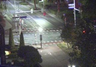





Set amid the reclaimed peatlands of northeastern Overijssel, Twenterand is a place whose character is shaped by centuries of drainage, peat cutting and farming. The municipality brings together Vriezenveen, Vroomshoop, Den Ham, Westerhaar-Vriezenveensewijk and Daarlerveen, where straight roads and waterways reflect the region’s planned settlement pattern. Near Vriezenveen, the Engbertsdijksvenen preserve a rare remnant of raised bog, with heath, pools and wet grassland. Vriezenveen also has an unusual international story: its Rusluie merchants traded with Saint Petersburg from the eighteenth century onward. Village life, rather than one urban centre, sets Twenterand’s pace. Move on to other webcams in Overijssel to compare landscapes and settings around Twenterand.
1 webcam
Overijssel has served as an eastern frontier region within the Netherlands since the Middle Ages. Its name, meaning “across the IJssel,” reflects the river that marks much of its western side, while the province extends east toward the German border. The Hanseatic cities of Zwolle, Deventer and Kampen developed through trade on the IJssel and still preserve historic centres shaped by that mercantile past. To the northwest, the peatlands, reed beds and waterways of Weerribben-Wieden National Park contrast with the wooded Salland and Twente interior. Cycling routes, waterways and compact cities make Overijssel an engaging introduction to the Netherlands beyond the Randstad. Browse additional webcams from the surrounding area to extend your view of Overijssel.
4 webcams
Among the countries of northwestern Europe, the Netherlands stands out for its carefully managed lowlands in the Rhine–Meuse–Scheldt delta. Much of the country lies low in relation to the sea, and dikes, dunes, pumps and polders are integral to its everyday geography. The North Sea coast ranges from broad beaches to the Wadden Sea, a tidal area shared with Germany and Denmark. Amsterdam’s 17th-century canal ring recalls an era when Dutch trade connected the republic with ports around the world. Beyond the capital, bicycles, dairy farming, bulb fields and compact historic cities give the country a distinct rhythm. Rotterdam’s port and the Delta Works show how maritime commerce and water engineering remain central. View additional webcams nearby to better understand how the Rhine–Meuse–Scheldt delta relates to its North Sea surroundings.
131 webcams