Patsch
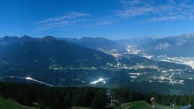
Patscherkofel defines the setting of Gemeinde Patsch — the municipality lies on its lower slopes above the Sill and the Wipp Valley, just south of Innsbruck. This position places Patsch between Tyrol’s capital and the Brenner route towards Italy, while its compact settlement remains clearly distinct from the city. The parish church of St Donatus forms a focal point in the old centre, and roads climb from the village towards the Patscherkofel hiking and ski area. Patsch belongs to the Innsbruck-Land district, where mountain communities, major transport corridors and the Inn Valley meet at close range. Continue through nearby webcams to explore different parts of Patsch, Innsbruck and the Wipp Valley. Generated by AI
5 webcams


Featured webcams



Popular webcams
Recently added webcams