Mount Ayr
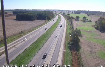
Mount Ayr straddles U.S. Route 41 in northwestern Indiana, and this north–south highway has shaped the unincorporated settlement as a rural crossroads. Indiana State Road 114 meets the route here, placing the community amid Newton County’s grid of farms and local roads. Mount Ayr lies in the Kankakee River watershed; the river’s lowland corridor is a defining feature of the county. U.S. 41 follows the historic Dixie Highway corridor, while the surrounding countryside reflects drainage projects that converted much of the former Grand Kankakee Marsh to farmland. Browse other webcams across Newton County and northwestern Indiana to place this setting in a wider geographic context. Generated by AI
1 webcam


Featured webcams
Popular webcams
Recently added webcams
Explore other webcams in Mount Ayr