Fordair
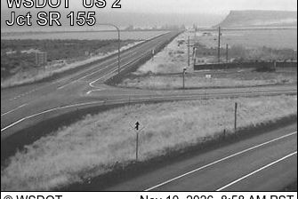
Fordair occupies the southern reaches of Grand Coulee on the Columbia Plateau in central Washington. This broad, steep-sided channel belongs to the Channeled Scablands, terrain cut by immense Ice Age floods. Banks Lake, a reservoir impounded by Dry Falls Dam, extends north through the coulee, while nearby Dry Falls preserves the remains of a far larger prehistoric cataract. Basalt cliffs, open shrub-steppe and farmland define the area more than urban development. Coulee City and Sun Lakes–Dry Falls State Park are close by, connecting Fordair to one of eastern Washington's most distinctive flood-shaped landscapes. Browse other webcams across Washington's Columbia Plateau to place Fordair in a wider geographic context. Generated by AI
1 webcam


Featured webcams
Popular webcams
Recently added webcams
Explore other webcams in Fordair