Doyle
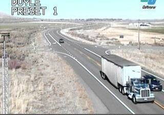
Few communities in northeastern California have a history as closely tied to the Western Pacific Railroad as Doyle. The settlement grew around a rail stop in the early 20th century, and the tracks still cross the broad, dry Honey Lake Valley. Doyle lies on U.S. Route 395, south of Honey Lake and near the Nevada line, where the open basin rises toward the eastern foothills of the Sierra Nevada. It is a working road-and-rail community whose character has long been shaped by travel across Lassen County. Find related webcams in Honey Lake Valley and the Sierra Nevada foothills to build a fuller picture of Doyle and northeastern California. Generated by AI
1 webcam


Featured webcams
Popular webcams
Recently added webcams
Explore other webcams in Doyle