Dogtown
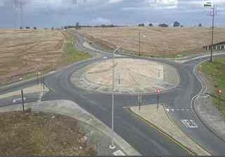
Dogtown lies along California’s eastern Central Valley, where cultivated lowlands begin to rise toward the lower foothills of the Sierra Nevada. This small San Joaquin County locality is near the Mokelumne River corridor and the rural communities around Clements, east of Lodi. Agriculture shapes the surrounding countryside, with vineyards, orchards and fields supported by irrigation in the valley’s dry climate. California State Route 88 runs nearby, linking the area with the Sierra Nevada and the lowlands toward the Sacramento–San Joaquin Delta. Dogtown forms part of a working rural landscape rather than an urban centre. Browse additional webcams nearby to see how Dogtown relates to the Mokelumne River corridor and the wider Central Valley. Generated by AI
1 webcam


Featured webcams
Popular webcams
Recently added webcams
Explore other webcams in Dogtown