 Western Junction: Tumut - YTMU -> NW
Tumut Airport lies in the Tumut River valley, where open grazing country meets the low, wooded foothills of the Snowy Mountains in southern New South Wales. It serves Tumut, a regional town set between river flats and the higher country of the Great Dividing Range. Identified by the code YTMU, the airfield has the compact character of a regional airport, with runways, hangars and farmland rather than dense urban development. Pastoral farming and forestry have long shaped the Tumut district, while the Tumut River forms part of the wider Snowy Mountains Scheme, Australia’s major hydroelectric and irrigation project. Roads from the town lead towards the high country and national parks of the south-east.
Generated by AI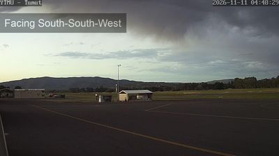


Western Junction straddles the Bass Highway–Evandale Road junction in northern Tasmania, and that transport position has made it a practical arrival point for the Launceston area. Launceston Airport is based here, linking this low-lying inland district with Australian cities and giving the settlement a role beyond its modest scale. The South Esk River runs nearby through farmland before joining the Tamar system farther north. For a historical counterpoint, neighbouring Evandale is known for its nineteenth-century Georgian streetscape and annual National Penny Farthing Championships. Browse other webcams across northern Tasmania to place this setting in a wider geographic context.
1 webcam
Among Australia’s regions, Tasmania stands out for its island setting south of Bass Strait and its large tracts of protected wilderness. Rugged mountain country, temperate rainforest and a deeply indented coastline give the state a character distinct from mainland Australia. Cradle Mountain–Lake St Clair National Park forms part of the Tasmanian Wilderness World Heritage Area, while Lake St Clair lies among the Central Highlands. On the Tasman Peninsula, Port Arthur preserves one of Australia’s best-known former convict settlements and is included in the UNESCO-listed Australian Convict Sites. Trace Tasmania’s place between Bass Strait and the Southern Ocean by browsing webcams nearby.
62 webcams
Australia’s terrain extends from tropical rainforests in the northeast to arid plains in the interior, producing dramatic climatic contrasts. The Great Dividing Range follows much of the eastern coast, while the Great Barrier Reef lies off Queensland in the Coral Sea and Uluru rises from the central desert. Aboriginal and Torres Strait Islander peoples maintain living cultures whose connections to Country long predate European settlement. In Sydney, the sail-like Opera House, completed in 1973, stands beside one of the world’s best-known harbours. Discover further points of interest through webcams located across Australia.
1.5K webcams