 Washington: Recreation Department - Chuck Brown Memorial Park
The Anacostia River watershed defines the setting of Chuck Brown Memorial Park in Northeast Washington — a compact civic space in the low, built-up terrain of the District. The park commemorates Chuck Brown, the Washington musician known as the Godfather of Go-Go, whose rhythmic, percussion-led style became a defining sound of the city. Its circular stone memorial plaza, lawn and adjoining recreation building make the site both a tribute and a neighborhood public facility. It belongs to the District’s Parks and Recreation network, giving everyday activity a place alongside recognition of a major local musical figure.
Generated by AI
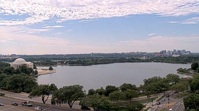





The landscape around Washington is a low, rolling river plain beside the Potomac River, which has shaped both the city’s riverfront development and its local economy. As the United States capital, it is defined by the monumental axis of the National Mall, running between the U.S. Capitol and the Lincoln Memorial, with the Washington Monument at its centre. Pierre Charles L’Enfant’s 1791 plan gave the city its broad avenues, diagonal streets and formal public spaces. Smithsonian museums, national memorials and the White House make downtown a focal point for civic life as well as visitors. Continue with other webcams from the area to see how the District of Columbia connects with Maryland and Virginia.
6 webcams
Established on the Potomac River as the federal capital, the District of Columbia developed into the political centre of the United States. Its monumental core, the National Mall, runs from the US Capitol to the Lincoln Memorial, with the Washington Monument near its centre. The White House stands just north of the Mall, while Smithsonian museums bring nationally important collections of art, science and history into the city’s everyday fabric. Beyond the ceremonial avenues are row-house neighbourhoods, restaurants and an international urban population. The National Cherry Blossom Festival recalls the Japanese cherry trees presented to Washington in 1912. Explore nearby webcam locations that provide complementary perspectives on Washington, DC.
7 webcams
The Atlantic, Pacific and Gulf coasts define much of the United States — their ports, fisheries and trade routes have long tied the country’s economy to the wider world. Between them, the Rocky Mountains, Great Plains and Mississippi River basin form sharply different regions, from high western ranges to broad agricultural heartlands. Cities carry much of the national story: New York’s Statue of Liberty, a gift from France dedicated in 1886, remains an enduring symbol, while Washington, DC concentrates major federal institutions. Indigenous nations have shaped these lands for millennia, and their living cultures remain essential to the country’s identity. Find related webcams in the surrounding areas to build a fuller picture of the United States.
32K webcams