 Warsaw
Tucked along the Vistula River, Warsaw is a city whose character is shaped by the river’s broad corridor across the Mazovian Plain. Its central skyline brings together post-war landmarks and contemporary office towers, with the Palace of Culture and Science, completed in 1955, remaining one of the capital’s most recognizable structures. The urban fabric reflects a dramatic 20th-century history: much of Warsaw was destroyed during the Second World War, while the Old Town was painstakingly reconstructed and later inscribed on the UNESCO World Heritage List. Parks and mature tree cover soften the dense core, while the Vistula runs along central Warsaw’s eastern side.
Generated by AI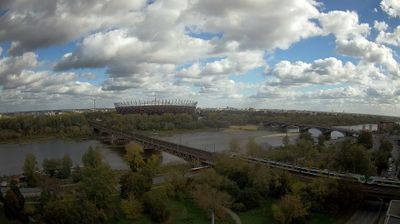
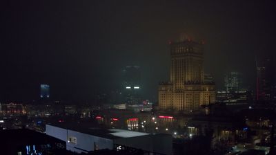

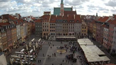




Few cities in Masovian Voivodeship have a history as closely tied to wartime destruction and postwar reconstruction as Warsaw. Set on the Vistula, Poland’s capital extends across both banks, although its historic core lies on the left. The Old Town, rebuilt after World War II from surviving fragments, paintings and documentation, entered the UNESCO World Heritage List in 1980 as an exceptional example of near-total reconstruction. The Royal Castle and Sigismund’s Column at Castle Square recall Warsaw’s role as a royal seat, while the Palace of Culture and Science marks its twentieth-century transformation. Continue with other webcams from the area to see how this part of Masovian Voivodeship connects regionally.
9 webcams
Masovian Voivodeship combines the metropolitan momentum of Warsaw with the open character of river plains in a way that reflects its position within Poland’s central lowlands. The Vistula runs through the region and past the capital, whose historic centre was rebuilt after the Second World War and is listed by UNESCO. Beyond Warsaw, Masovia spreads into farmland, woodland and smaller towns, with the Bug and Narew among the waterways shaping its eastern and northern reaches. This is Poland’s political centre, but regional customs also endure in local food, music and seasonal events. Explore nearby locations that provide complementary perspectives on Masovia.
35 webcams
Poland stretches from the Baltic Sea coast in the north to the Carpathian Mountains along its southern frontier, encompassing broad lowlands, lake districts and upland ranges. The Vistula, the country’s longest river, links Kraków and Warsaw before reaching the Baltic near Gdańsk, while the Masurian Lake District is defined by a dense network of lakes. Kraków’s historic centre, including Wawel Castle, recalls Poland’s former royal capital; Warsaw’s rebuilt Old Town speaks to the city’s recovery after the Second World War. The Białowieża Forest preserves one of Europe’s last primeval lowland forests and is home to European bison. Follow how Poland’s regions relate to one another by browsing webcams across the country.
716 webcams