 Utqiaġvik: NOAA GML (formerly CMDL) Barrow
Few places in Alaska have a history as closely tied to long-term atmospheric monitoring as NOAA GML’s Barrow Observatory near Utqiaġvik. Established in 1973 on the Arctic coastal plain, the station is part of NOAA’s global network for tracking the composition of the atmosphere, including greenhouse gases. Its setting beside the Arctic Ocean is a low, treeless expanse of tundra and wetlands, shaped by permafrost and shallow water. Utqiaġvik, Alaska’s northernmost city, is an Iñupiat community whose coastal life has long depended on the Arctic Ocean. The observatory’s remote location supports measurements intended to represent air arriving from across the Arctic rather than from urban sources.
Generated by AI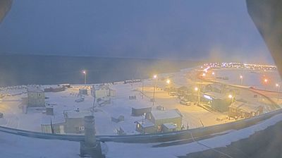

Utqiaġvik combines a living Iñupiat cultural tradition with an uncompromising Arctic climate in a way that reflects its position on Alaska’s Chukchi Sea coast. Formerly known as Barrow, it is the northernmost city in the United States, close to Point Barrow, Alaska’s northernmost headland. Polar night shapes the winter months, while the summer brings weeks of continuous daylight. Subsistence bowhead whaling remains central to local life, and the Iñupiat Heritage Center introduces the knowledge, arts and traditions of the region’s Indigenous people. Move on to other webcams in Alaska to compare Arctic coastlines and settlement settings around Utqiaġvik.
2 webcams
Built around the homelands of Indigenous peoples and later linked by fur-trade and mining routes, Alaska grew into the largest state in the United States. These coordinates lie in the Interior, where the Tanana River crosses a country of broad lowlands, boreal forest and long winters. Alaska extends from the Gulf of Alaska to the Arctic Ocean and includes Denali, North America’s highest mountain. Athabascan communities remain central to the living cultural fabric of the interior. The Alaska Railroad reached Fairbanks in 1923, helping connect this remote region with the coast. Browse additional webcams from the surrounding area to extend your view of Interior Alaska.
413 webcams
The Atlantic, Pacific and Gulf coasts define much of the United States — their ports, fisheries and trade routes have long tied the country’s economy to the wider world. Between them, the Rocky Mountains, Great Plains and Mississippi River basin form sharply different regions, from high western ranges to broad agricultural heartlands. Cities carry much of the national story: New York’s Statue of Liberty, a gift from France dedicated in 1886, remains an enduring symbol, while Washington, DC concentrates major federal institutions. Indigenous nations have shaped these lands for millennia, and their living cultures remain essential to the country’s identity. Find related webcams in the surrounding areas to build a fuller picture of the United States.
32K webcams