 Tychy
Tychy has served as an industrial centre in Upper Silesia since the mid-20th century. The city developed rapidly after the Second World War, when planned housing districts were built for workers in the expanding Silesian conurbation. Its urban fabric combines broad residential estates and mature greenery, while the Gostynia River runs through the municipal area on its way to the Vistula. Tychy is also identified with the Tyskie brewery, whose origins date to 1629; brewing remains one of the city’s best-known traditions. Car production has added another major strand to the local economy, making Tychy a substantial urban centre south of Katowice. It is a city shaped by postwar planning as well as the region’s industrial heritage.
Generated by AI


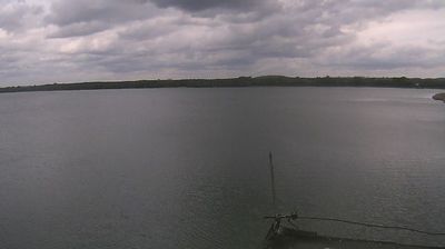



The landscape around Tychy is gently rolling, with woodland and the Gostynia River valley, which has shaped both the urban form and local economy. This southern part of the Upper Silesian metropolitan area combines post-war planned neighbourhoods with older districts and substantial green space. Paprocany Lake, a reservoir on the Gostynia, is a prominent local recreation area. Tychy is also closely identified with Tyskie beer: brewing in the town dates to 1629, and the historic brewery remains an important symbol of the city. Browse other locations across the Silesian Voivodeship to place Tychy in a wider geographic context.
3 webcams
Among Poland’s voivodeships, the Silesian Voivodeship stands out for its densely populated industrial heartland framed by the Kraków-Częstochowa Upland and the Beskids. Katowice anchors a large urban area whose coal, steel and manufacturing traditions helped shape modern Poland. To the north, Częstochowa is home to the Jasna Góra monastery, a major pilgrimage destination associated with the revered icon of the Black Madonna. The Vistula, Poland’s longest river, rises in the Silesian Beskids near the southern border, where the region shifts into forested mountain country. Explore nearby webcam locations that provide complementary perspectives on the Silesian Voivodeship.
82 webcams
Poland stretches from the Baltic Sea coast in the north to the Carpathian Mountains along its southern frontier, encompassing broad lowlands, lake districts and upland ranges. The Vistula, the country’s longest river, links Kraków and Warsaw before reaching the Baltic near Gdańsk, while the Masurian Lake District is defined by a dense network of lakes. Kraków’s historic centre, including Wawel Castle, recalls Poland’s former royal capital; Warsaw’s rebuilt Old Town speaks to the city’s recovery after the Second World War. The Białowieża Forest preserves one of Europe’s last primeval lowland forests and is home to European bison. Follow how Poland’s regions relate to one another by browsing webcams across the country.
718 webcams