 Town of Freeman: D2 - WI 82 @ MM 0.3 (Lansing Bridge - East)
The Town of Freeman straddles Wisconsin’s western edge along the Mississippi River in the Driftless Area, where the broad floodplain has shaped connections with neighboring Iowa. At Lansing, the Wisconsin Highway 82 crossing links the rural Wisconsin shore to Iowa; the original Black Hawk Bridge opened in 1931 and was named for the Sauk leader Black Hawk. Freeman is a sparsely settled township in Crawford County, defined by wooded bluffs, bottomland, farms and working river infrastructure rather than an urban center. This reach of the Mississippi belongs to the Upper Mississippi River National Wildlife and Fish Refuge, a protected corridor for migratory birds and river habitats. It captures the practical role of an interstate crossing between Wisconsin’s Driftless terrain and the Mississippi valley.
Generated by AI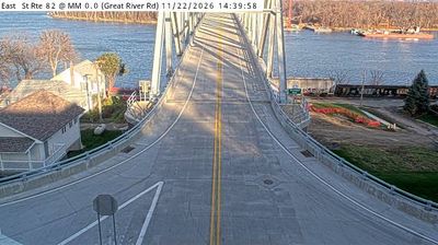

Town of Freeman extends along the Mississippi River in western Wisconsin, and its position between the river floodplain and Driftless Area bluffs has focused local life on the valley corridor. The town includes Ferryville, an unincorporated river community where Wisconsin Highway 35 follows the Great River Road. Along this stretch of river, the Upper Mississippi River National Wildlife and Fish Refuge protects islands, backwaters and marshes used by migratory birds. Freeman is a quiet base for following the river road and understanding how the Mississippi has shaped southwestern Wisconsin. Browse additional webcams from the Mississippi River corridor and western Wisconsin to extend your view of Town of Freeman.
1 webcam
Built around Great Lakes shipping, timber, and dairy farming, Wisconsin grew into a Midwestern state with a distinctive industrial and rural identity. Lake Michigan forms its eastern edge, while the Mississippi River marks much of the west; between them lie forests, farms, and thousands of inland lakes. Milwaukee, on Lake Michigan, developed as a major brewing centre, and the state’s dairy tradition remains central to its food culture. In the southwest, the Driftless Area escaped the flattening effects of the last continental glaciation, creating deeply cut river valleys and steep ridges. Find related webcams in the surrounding area to build a fuller picture of Wisconsin.
163 webcams
The Atlantic, Pacific and Gulf coasts define much of the United States — their ports, fisheries and trade routes have long tied the country’s economy to the wider world. Between them, the Rocky Mountains, Great Plains and Mississippi River basin form sharply different regions, from high western ranges to broad agricultural heartlands. Cities carry much of the national story: New York’s Statue of Liberty, a gift from France dedicated in 1886, remains an enduring symbol, while Washington, DC concentrates major federal institutions. Indigenous nations have shaped these lands for millennia, and their living cultures remain essential to the country’s identity. Find related webcams in the surrounding areas to build a fuller picture of the United States.
32K webcams