 Topčić Polje: Restoran "Lovac"
The Bosna River valley defines the setting of Topčić Polje — steep, wooded hills narrow the settlement into a ribbon of homes, small businesses and transport infrastructure on the valley floor. Topčić Polje stands in central Bosnia and Herzegovina, south of Zenica, along the M17, a principal road route through the country. The road links the Sarajevo and Doboj directions and gives the place a functional roadside rhythm, with local properties and services directly beside through-traffic. Forested Dinaric terrain rises beyond the built strip, while the valley remains the settlement's organising feature. This is a lived-in stop on the Bosna corridor, representative of the linear communities that follow Bosnia's river valleys.
Generated by AI




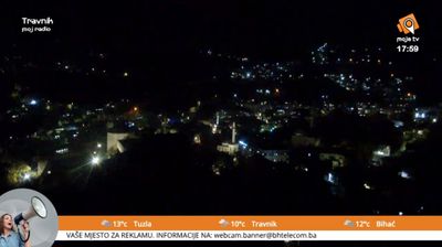





The landscape around Topčić Polje is a narrow, wooded valley along the Bosna River, which has shaped both the settlement pattern and the local economy. South of Zenica in central Bosnia, the community lies on the long-established transport route through the Bosna valley, followed by road and railway connections between Sarajevo and northern Bosnia. Fields and homes occupy limited level ground beneath steep slopes, keeping daily life closely connected to the river corridor. Topčić Polje became widely known after the floods and landslides of May 2014, which caused severe destruction in the area. Find related webcams in the Bosna valley to build a fuller picture of central Bosnia.
1 webcam
The Federation of Bosnia and Herzegovina combines rugged highlands with milder Herzegovinian river valleys in a way that reflects its position within the Dinaric Alps of the western Balkans. One of the two entities of Bosnia and Herzegovina, it extends from the Una basin near the Croatian border to the Neretva valley and the Adriatic-facing south. Sarajevo is its capital, while Mostar’s Old Bridge, rebuilt after the 1990s war and inscribed on UNESCO’s World Heritage List, remains a powerful symbol of the country’s urban heritage. Ottoman-era bazaars, mosques and bridges stand alongside Austro-Hungarian streetscapes, particularly in Sarajevo. Browse additional webcams from the surrounding area to extend your view of the Federation of Bosnia and Herzegovina.
77 webcams
Bosnia and Herzegovina is best known internationally for Mostar’s Old Bridge, the stone arch over the Neretva River rebuilt after the 1990s war. The country lies in the Dinaric Alps, where karst plateaus, steep valleys and fast rivers shape much of the terrain. Sarajevo combines Ottoman-era lanes in Baščaršija with Austro-Hungarian architecture, reflecting its role as a meeting point of cultural traditions. In the south, the Neretva valley leads towards a short Adriatic coastline near Neum, while the Una River is known for its waterfalls. Browse additional webcams from the surrounding area to extend your view of Bosnia and Herzegovina.
98 webcams