 Tompkins: Doyles
Among the communities of Newfoundland and Labrador, Doyles stands out for its position on the Trans-Canada Highway at the edge of the Codroy Valley. This small roadside settlement lies in the province’s southwest, where wooded low hills meet open valley land near the Gulf of St. Lawrence. The Codroy Valley is one of Newfoundland’s principal agricultural areas, with pasture and cultivated fields contrasting with the island’s more rugged terrain. Route 1 makes Doyles a practical stopping point between Port aux Basques and communities farther east, and its compact cluster of businesses reflects the long-distance road’s importance to daily travel and freight across the island.
Generated by AI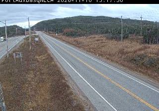

Tompkins occupies open, gently rolling prairie in southwestern Saskatchewan, beside the Trans-Canada Highway and the Canadian Pacific rail corridor. The village stands in a dryland farming belt where grain fields stretch across the plains, while the Cypress Hills rise to the south as a distinctly wooded upland. Its roadside position links local agricultural country with the larger centres of Swift Current and Medicine Hat. Quiet streets and a compact community core give Tompkins the practical character of a Saskatchewan highway settlement. View additional webcams nearby to better understand how Tompkins and southwestern Saskatchewan relate to the surrounding prairies.
1 webcam
Saskatchewan stretches from the United States border to the 60th parallel at the Northwest Territories, encompassing southern grain-growing plains and the boreal forest and Canadian Shield of the north. The South Saskatchewan River crosses the settled south, including Saskatoon, while the Churchill River runs through a northern country of lakes, rock and conifers. Regina, the provincial capital, is home to the Saskatchewan Legislative Building, completed in 1912. First Nations and Métis communities remain central to the province’s identity; Cree, Dene, Saulteaux and Métis traditions reflect both prairie and northern cultures. Move on to other webcams in the region to compare landscapes and settings around Saskatchewan.
62 webcams
Canada has served as a frontier between French and British colonial powers since the 17th century. The world’s second-largest country extends from Atlantic shores to the Pacific and Arctic coasts, with the Canadian Shield, the Rocky Mountains, the Great Lakes and the St. Lawrence River shaping its vast geography. First Nations, Inuit and Métis peoples are central to Canada’s identity, while Ottawa’s Parliament Hill represents its federal political life. French remains the official language of Quebec, adding a distinct dimension to the country’s public culture. See how Canada connects across North America by browsing webcams in neighbouring regions.
3.5K webcams