 Temirtau: Komsomol'skiy Prospekt - Mir Avenue
Temirtau sits on the Nura River in Kazakhstan’s Karaganda Region, where broad Soviet-planned avenues serve one of the country’s main steelmaking centres. Komsomol'skiy Prospekt and Mir Avenue belong to a rectilinear urban fabric of apartment blocks, shops and civic buildings laid out for an industrial city. The nearby integrated steelworks has shaped Temirtau’s growth since the Soviet period and remains central to its identity. The city also figures in Kazakhstan’s modern political history: Nursultan Nazarbayev worked here as a young steelworker in the 1960s. Temirtau is a practical, working city whose scale and street pattern are closely tied to heavy industry.
Generated by AI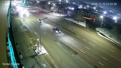


Temirtau combines the industrial force of a steelmaking city with the broad, low horizon of the Kazakh steppe in a way that reflects its position on the Nura River. The Samarkand Reservoir, formed on the river near the city, adds water to a landscape otherwise defined by dry continental conditions. Temirtau grew rapidly in the Soviet era around the Karaganda Metallurgical Combine, and its steelworks remain central to its identity. It was also where Kazakhstan’s first president, Nursultan Nazarbayev, began his working life as a steelworker. Browse other webcams across Karaganda Region to place Temirtau’s industrial steppe setting in a wider geographic context.
1 webcam
Karaganda Region occupies a broad expanse of upland steppe in central Kazakhstan. Its terrain belongs largely to Saryarka, the Kazakh Uplands, where open grasslands are broken by low rocky hills, dry valleys and scattered lakes; Lake Balkhash marks an important southern edge of the region. The Nura River is among the waterways crossing this continental interior. Karaganda, the regional capital, grew around one of Kazakhstan’s principal coal basins, and mining remains central to the area’s identity. Farther east, the wooded granite slopes of Karkaraly National Park contrast with the surrounding steppe. Continue with other webcams from the area to see how this part of central Kazakhstan connects regionally.
3 webcams
Kazakhstan combines nomadic steppe heritage with a rapidly modernising urban identity in a way that reflects its position between Europe and Central Asia. The country stretches from the Caspian Sea in the west across immense grasslands to the Altai and Tian Shan mountain systems in the east and southeast. Astana, its capital, is known for bold contemporary architecture, while Almaty lies near the northern Tian Shan foothills. In the south, Turkistan is home to the Mausoleum of Khoja Ahmed Yasawi, a major monument of Timurid architecture and a UNESCO World Heritage site. Baikonur Cosmodrome launched the first human into space in 1961. Discover other points of interest through webcams located across Kazakhstan.
18 webcams