 Tanvald: Ski Areál Tanvaldský Špičák II
Tucked into the forested slopes of the Jizera Mountains, Ski Areál Tanvaldský Špičák II is a place whose character is shaped by ski runs cut through conifer woodland. It forms part of the Tanvaldský Špičák resort in the Tanvald area, an established winter-sports centre in northeastern Czechia. The runs and lift corridors follow the rolling mountain terrain rather than an urban setting, creating a distinctly upland character. Tanvald lies below in the valley, while the Jizera Mountains are crossed by an extensive network of marked routes. A regional engineering landmark is the Tanvald–Kořenov railway, opened in 1902; its rack section reflects the demanding gradients of this mountain country.
Generated by AI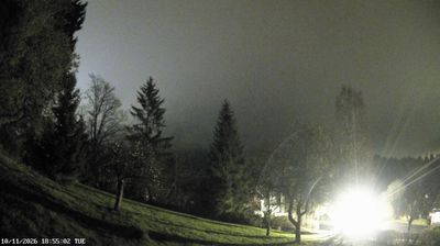




The Kamenice River defines the setting of Tanvald — its valley threads the town between the wooded slopes of the Jizera Mountains, concentrating homes, roads and rail lines in a compact mountain corridor. Developed as a textile and industrial centre in the 19th century, Tanvald still carries the working character of a northern Bohemian rail town. Its most distinctive route is the Tanvald–Kořenov railway, with a historic cog section climbing towards the mountain pass at Kořenov. Forest paths, cycling routes and winter-sports areas extend into the surrounding uplands, while the river valley keeps the centre close-knit. Continue with other webcams from the area to see how this part of the Liberec Region connects regionally.
6 webcams
Liberec Region is best known in Czechia for Ještěd, the mountain above Liberec crowned by its unmistakable hotel and television tower. In the country’s north, the region reaches from the Jizera Mountains towards the Krkonoše and Lusatian Mountains, while the Nisa River runs through Liberec and continues north into Poland and Germany. Liberec, the regional capital, developed as an important textile-manufacturing centre; its 19th-century Town Hall remains one of the city’s defining buildings. Borderland geography gives the area a distinctly Central European character, with mountain resorts, forest roads and historic towns close together. Browse additional webcams from the surrounding area to extend your view of Liberec Region.
95 webcams
The terrain of Czechia ranges from fertile lowlands in southern Moravia to mountain ridges along the northern frontier, giving this Central European country a distinctly varied geography. The Vltava runs through Prague before joining the Elbe, while the Krkonoše form part of the border with Poland and include Sněžka, Czechia’s highest mountain. Prague’s historic centre, with Prague Castle and Charles Bridge, reflects the city’s long role as a political and cultural centre. Beyond the capital, Bohemia is known for spa towns and brewing, and Moravia for wine-growing traditions. View additional webcams nearby to better understand how Czechia relates to its Central European surroundings.
1.2K webcams