 Steinhagen: Nordrhein-Westfalen, Deutschland
Among the places of North Rhine-Westphalia, Steinhagen stands out for its position on the northern slopes of the Teutoburg Forest. From its wooded heights, the terrain falls towards the Westphalian lowlands, bringing forest, fields and residential areas together. Steinhagen lies west of Bielefeld and forms part of the cultural landscape on the edge of the Teutoburg Forest. Its best-known local product is Steinhäger, a juniper spirit traditionally made in the town; the name is protected as a geographical indication. This is a settled corner of Ostwestfalen-Lippe where agricultural land and broad woodland stand close to one another. Steinhagen was first documented in 1258.
Generated by AI

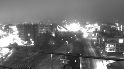


Tucked into open farmland west of the Strelasund, Steinhagen is a place whose character is shaped by its rural position on the mainland of Vorpommern. The Baltic strait separates this coast from the island of Rügen, while nearby Stralsund is the area’s main urban and maritime centre. Stralsund’s historic core, distinguished by Brick Gothic churches and merchants’ houses, is a UNESCO World Heritage site. Steinhagen belongs to a setting of fields, small settlements and local roads rather than the Baltic resort coast. The wider region formed part of Swedish Pomerania until 1815. Discover other points of interest through webcams located across Mecklenburg-Vorpommern.
1 webcam
Mecklenburg-Vorpommern is best known within Germany for its Baltic Sea coastline, including the islands of Rügen and Usedom. Its northern edge meets the Baltic, while the interior is marked by lakes, lowland forests and farmland; Lake Müritz is Germany’s largest lake lying entirely within the country. The white chalk cliffs of Jasmund National Park on Rügen are among the state’s defining coastal formations. Stralsund and Wismar retain historic Hanseatic town centres, both inscribed on UNESCO’s World Heritage List. Ports, seaside resorts and lake districts give the region a distinctly northern character. Continue with other webcams from the area to see how this part of northeastern Germany connects regionally.
88 webcams
Germany stretches from the North Sea and Baltic Sea coasts to the Alps on its southern border, encompassing northern plains, river valleys and forested uplands. The Rhine, Danube and Elbe have long connected its regions, while the Black Forest and Bavarian Alps give the south a more dramatic relief. Berlin’s Brandenburg Gate and Museum Island reflect the capital’s role in German history and culture. Cologne Cathedral, a UNESCO World Heritage Site, rises above the Rhine, and the Bauhaus movement, founded in Weimar in 1919, transformed modern design far beyond Germany. Regional cooking, Christmas markets and brewing traditions bring further character to daily life. Browse additional webcams from the surrounding area to extend your view of Germany.
2.2K webcams