 Srebrna Gora
Srebrna Góra has served as a mining settlement in Lower Silesia since the Middle Ages. Set in the Góry Bardzkie of the Sudetes, the small town occupies a steep, wooded upland above the Kłodzko Valley. Its defining monument is the Fortress of Srebrna Góra, a major Prussian defensive complex built between 1765 and 1777 on the orders of Frederick II. The main stronghold, the Donjon, was designed as a self-contained fortification, with casemates, ramparts and garrison facilities integrated into the slopes. The surviving works are an important example of eighteenth-century military architecture in Poland. Old streets, stone retaining walls and mountain paths reinforce the settlement's former frontier character.
Generated by AI






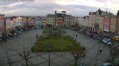

Srebrna Góra is best known in Poland for the Srebrna Góra Fortress, an 18th-century Prussian stronghold. The town occupies a pass in the Sudetes, between the Owl Mountains and the Bardzkie Mountains, and its steep setting helped determine the fortress’s defensive role. Commissioned by Frederick II of Prussia after Silesia came under Prussian rule, the complex was built from 1765 to 1777; its central donjon remains its defining structure. Today, this small Lower Silesian settlement is closely identified with the fortress and with routes through the surrounding mountain country. Find related webcams in the surrounding area to build a fuller picture of Srebrna Góra and Lower Silesia.
1 webcam
Among the regions of Poland, Lower Silesian Voivodeship stands out for the meeting of the Sudetes, the Oder valley and historic Wrocław. Its southern edge reaches the Karkonosze range, where Śnieżka rises as the highest peak of the Sudetes, while broad lowlands and river corridors shape the north. Wrocław is the regional centre, known for its Market Square, the cathedral district of Ostrów Tumski and the UNESCO-listed Centennial Hall. Further west, Książ Castle near Wałbrzych recalls the area’s long Silesian past. Browse additional webcams around the region to extend your view of Lower Silesia.
73 webcams
Poland stretches from the Baltic Sea coast in the north to the Carpathian Mountains along its southern frontier, encompassing broad lowlands, lake districts and upland ranges. The Vistula, the country’s longest river, links Kraków and Warsaw before reaching the Baltic near Gdańsk, while the Masurian Lake District is defined by a dense network of lakes. Kraków’s historic centre, including Wawel Castle, recalls Poland’s former royal capital; Warsaw’s rebuilt Old Town speaks to the city’s recovery after the Second World War. The Białowieża Forest preserves one of Europe’s last primeval lowland forests and is home to European bison. Follow how Poland’s regions relate to one another by browsing webcams across the country.
711 webcams