 Springs Junction: SH7/SH65
Springs Junction occupies a road junction in the upper Maruia Valley on New Zealand’s West Coast. State Highway 7 follows the Lewis Pass route between the West Coast and Canterbury, while State Highway 65 turns through the Maruia Valley towards Murchison. The settlement is a practical stopping point rather than a town centre: roadside fuel, food and parking serve travellers moving through a sparsely settled interior. Forested hills and high-country ranges frame the valley, and the Maruia River belongs to the Buller River catchment. Its character is defined by long-distance road travel linking the West Coast with the South Island’s interior.
Generated by AI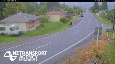

Few settlements on the West Coast have a history as closely tied to overland routes between Canterbury and the coast as Springs Junction. This small roadside locality lies beside the Maruia River, where State Highway 7, following the Lewis Pass corridor, meets State Highway 65 towards Murchison. Beech forest, river flats and mountain terrain define the surrounding inland country. Lewis Pass is one of the South Island’s three principal road crossings of the Southern Alps, giving Springs Junction a practical role in travel between the east and west. Discover other points of interest through webcams located across the West Coast.
1 webcam
West Coast is best known within New Zealand for glaciers that descend from the Southern Alps toward the Tasman Sea. This narrow, rain-fed belt on the South Island’s western side runs between a wild coastline and densely forested mountains, with the Grey River meeting the sea at Greymouth, the region’s largest town. Gold and coal helped shape many West Coast settlements, while pounamu, or New Zealand jade, remains an important taonga in Māori culture. North of Greymouth, Paparoa National Park protects limestone country and the coast around Punakaiki. Browse other webcams across New Zealand’s West Coast to place this shoreline and alpine hinterland in a wider geographic context.
12 webcams
New Zealand combines Pacific isolation with strong ties to the wider South Pacific in a way that reflects its position between the Tasman Sea and the open Pacific Ocean. The country’s two main islands are divided by Cook Strait, while the Southern Alps run along much of the South Island and include Aoraki / Mount Cook, its highest mountain. On the North Island, volcanic terrain shapes Tongariro National Park and the central plateau; long coastlines frame cities such as Auckland and Wellington. Māori culture is central to national life, and the Treaty of Waitangi, first signed in 1840, remains a foundational document in relations between Māori and the Crown. See how New Zealand fits within the wider South Pacific by browsing webcams nearby.
482 webcams