 Shadrinsk: Shadrinskiy - Kurgan Oblast, Russia
Tverdyshsky Selsoviet straddles the transition between Shadrinsk’s outer development and the open West Siberian Plain in Kurgan Oblast, a position that has given this rural administrative area a distinctly roadside, service-oriented character. It lies in the wider basin of the Iset, the river that runs through nearby Shadrinsk. Low-rise housing, small businesses and agricultural land meet along the approaches to the city rather than forming a dense urban centre. Shadrinsk provides the local cultural reference point: sculptor Ivan Shadr took his artistic name from the town where he was born. The setting reflects the everyday geography of inland Russia, where regional roads connect settlements across a broad, level plain.
Generated by AI

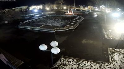

The Iset River defines the setting of Shadrinsk — its valley has long provided a route and a focus for settlement in the Trans-Urals of Kurgan Oblast. Founded in 1662 as Shadrinskaya Sloboda, the town developed as a regional commercial centre and received town status in 1781. Streets near the centre retain the measured scale of a nineteenth-century provincial town, with brick merchants’ houses and public buildings. The eighteenth-century Spaso-Preobrazhensky Cathedral is one of its best-known historic landmarks. Shadrinsk is also associated with the Shadrinsk goose, a traditional Russian breed developed locally. Place Shadrinsk in its wider Trans-Ural context by browsing webcams across Kurgan Oblast.
4 webcams
The Tobol River defines much of Kurgan Oblast - its broad lowland basin has long supported farming, settlement and transport across Russia’s Trans-Ural interior. East of the Ural Mountains, the oblast is a land of open steppe, birch woodland, lakes and cultivated fields, with the Tobol flowing north toward the Irtysh. Kurgan, the regional capital, takes its name from a burial mound; it developed as a frontier settlement and is associated with the Decembrists who lived here in exile. The region’s quieter provincial character contrasts with the industrial centres farther west in the Urals. Explore nearby locations that provide complementary perspectives on Kurgan Oblast.
5 webcams
Russia has served as a major power between Europe and Asia since the 16th century. Its territory crosses eleven time zones, extending from the Baltic coast and the East European Plain over the Ural Mountains to the Pacific. The Volga, Europe’s longest river, runs through a core of historic Russian settlement, while Lake Baikal in Siberia is the world’s deepest lake. Moscow’s Kremlin and Red Square stand at the centre of the capital’s political and architectural heritage; Saint Petersburg’s Hermitage Museum occupies the Winter Palace. Orthodox churches, Russian-language literature, ballet and long-distance rail travel remain familiar reference points in a country of immense regional contrasts. Continue with other webcams from Russia to see how this part of northern Eurasia connects regionally.
461 webcams