 Sakyō Ward: Ginshadan - Hoshokan - Kogetsudai
Few places in Kyoto Prefecture have a history as closely tied to the late Muromachi shogunate as Ginkaku-ji. Ashikaga Yoshimasa established it in 1482 as a retirement villa, and following his death it became the Zen temple formally called Jishō-ji. Its restrained setting beneath the wooded Higashiyama hills became closely associated with the Higashiyama culture fostered under Yoshimasa. The famed sand garden is organized around Ginshadan, a broad raked field of white sand, and Kogetsudai, a conical sand form linked to moon viewing. The two-storey Kannon Hall, widely known as the Silver Pavilion, joins these compositions with pine trees, moss and carefully tended grounds.
Generated by AI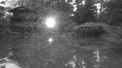




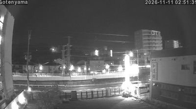

The upper valley of the Takano River defines the setting of Sakyo Ward — in this far-northern part of Kyoto, wooded slopes and narrow rural roads replace the dense streets associated with the city centre. This mountainous area forms a transition between the Kyoto Basin and the interior of Kyoto Prefecture, with small settlements scattered along watercourses. Sakyo Ward also encompasses renowned cultural sites farther south: Ginkaku-ji, the Silver Pavilion, stands below the Higashiyama hills, while the 17th-century Shugakuin Imperial Villa is celebrated for its gardens. The ward’s broad extent reveals Kyoto’s progression from an urban historic centre to deeply forested uplands. Continue with other webcams from the area to see how this northern part of Kyoto Prefecture connects regionally.
2 webcams
The terrain of Kyoto Prefecture ranges from the rugged Sea of Japan coast in the north to the lowlands of the Kyoto Basin in the south, creating pronounced contrasts within a compact area. The Tango Peninsula and the celebrated sandbar of Amanohashidate define the northern shore, while the prefectural capital is threaded by the Kamo River. Kyoto was Japan’s imperial capital for more than a millennium, and its temples, shrines and traditional districts remain central to the country’s cultural identity. Uji, south of Kyoto City, is also closely associated with Japanese green tea. Discover other points of interest through webcams located across Kyoto Prefecture.
10 webcams
Among the countries of East Asia, Japan stands out for its volcanic archipelago, stretching from the cool north of Hokkaido to subtropical Okinawa. Mount Fuji, the nation’s highest mountain, rises above central Honshu, while the Pacific Ocean and the Seto Inland Sea have long shaped settlement, fishing and travel. Tokyo pairs dense urban life with major museums and neighbourhood traditions; Kyoto preserves temples, gardens and the legacy of Japan’s imperial court. Seasonal customs give journeys a changing rhythm, from spring cherry blossom viewing to autumn leaves. Regional cooking is equally varied, with sushi, ramen and local specialties reflecting coastlines, climate and agriculture. Explore nearby webcam locations that provide complementary perspectives on Japan’s islands, cities and mountain regions.
1.3K webcams