 Rockdale: I-90 at MP 49.3
Among the places of Washington, Rockdale stands out for its position on Interstate 90 in the densely forested Cascade Mountains. This small roadside locality lies near Snoqualmie Pass, one of the principal crossings between western Washington and the inland side of the state. Conifer forest and steep mountain terrain shape the I-90 corridor here, giving the route a distinctly high-country character rather than the feel of an urban highway. Snoqualmie Pass is an important link across the Cascades, and I-90 connects the Puget Sound region with central Washington. Rockdale is best understood as part of a working mountain transport landscape, close to the pass rather than a conventional town centre.
Generated by AI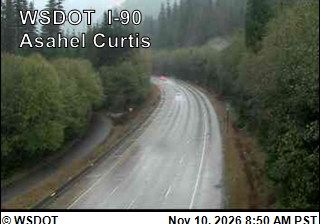
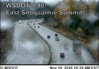
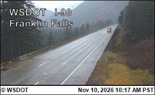
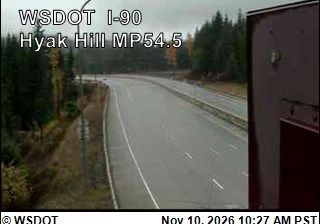

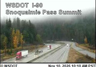



Built around a stop on the Milwaukee Road railway, Rockdale grew into a small mountain community on the South Fork Snoqualmie River in Washington’s Cascade Mountains. The settlement lies beside Interstate 90, within the steep, forested corridor leading toward Snoqualmie Pass. Its rail heritage continues on the Palouse to Cascades State Park Trail, which follows the former Milwaukee Road grade through this section of the range. Nearby, the Snoqualmie Tunnel, completed in 1914, carries the route beneath the pass. Rockdale illustrates how rail construction and later highways threaded through this rugged part of King County. Discover other points of interest through webcams located across Washington’s Cascades.
2 webcams
Washington’s terrain runs from Pacific coastal lowlands in the west to the dry Columbia Plateau in the east, with the Cascade Range creating a marked climatic divide. Central Washington lies on the plateau side of the Cascades, where the Columbia River has cut broad valleys and irrigation supports orchards and vineyards. The state also includes Puget Sound, the intricate marine inlet around Seattle, and the volcanic cone of Mount Rainier. Seattle’s Space Needle, built for the 1962 World’s Fair, remains one of its most recognisable landmarks. Move on to other webcams in the region to compare landscapes and settings around Washington.
1.5K webcams
The Atlantic, Pacific and Gulf coasts define much of the United States — their ports, fisheries and trade routes have long tied the country’s economy to the wider world. Between them, the Rocky Mountains, Great Plains and Mississippi River basin form sharply different regions, from high western ranges to broad agricultural heartlands. Cities carry much of the national story: New York’s Statue of Liberty, a gift from France dedicated in 1886, remains an enduring symbol, while Washington, DC concentrates major federal institutions. Indigenous nations have shaped these lands for millennia, and their living cultures remain essential to the country’s identity. Find related webcams in the surrounding areas to build a fuller picture of the United States.
32K webcams