 Rjukan: sett mot vest
The narrow Vestfjordalen valley defines the setting of Rjukan — its steep, wooded walls compress homes, roads and industry into the valley floor beside the Måna River. This former company town grew around hydropower development in the early 20th century, when Norsk Hydro built major facilities in and around the valley. Rjukan and nearby Notodden form the Rjukan–Notodden Industrial Heritage Site, inscribed on UNESCO’s World Heritage List in 2015 for its role in the second industrial revolution. The town is also closely associated with Vemork, where the wartime heavy-water operation became a landmark episode of Norwegian resistance. The surrounding valley remains a defining part of daily life rather than merely a backdrop.
Generated by AI
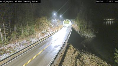



Among the cities of Vestfold og Telemark, Rjukan stands out for its industrial heritage in the narrow Vestfjorddalen valley beneath Gaustatoppen. The Måna river once powered the factories that made the town a centre of Norway’s early twentieth-century industrialisation. Vemork, the former hydroelectric plant above Rjukan, now houses the Norwegian Industrial Workers Museum and recalls the 1943 heavy-water sabotage during the Second World War. Rjukan–Notodden Industrial Heritage Site has been on UNESCO’s World Heritage List since 2015. Mirrors installed on the mountainside bring winter sunlight into the town square. Explore nearby webcam locations that provide complementary perspectives on Rjukan and Telemark.
2 webcams
Telemark combines rugged mountain country with calm inland waterways in a way that reflects its position within southeastern Norway. Forested valleys, broad lakes and upland terrain give the region a markedly varied character, from the edge of the Hardangervidda plateau to settled districts further south. The Telemark Canal links Skien and Dalen through lakes and a sequence of historic locks, creating one of Norway’s best-known inland water routes. In Notodden, Heddal Stave Church stands as Norway’s largest surviving stave church, a powerful reminder of the region’s long craft traditions. Browse other webcams across Telemark to place this setting in a wider geographic context.
56 webcams
Norway has served as a seafaring link between the North Atlantic and northern Europe since the Viking Age. Its long coastline is cut by fjords, while the Lofoten archipelago rises sharply from the Norwegian Sea and the mountains of Jotunheimen include Galdhøpiggen, Norway’s highest peak. Bergen’s Bryggen, the former Hanseatic wharf, recalls centuries of maritime trade. Farther north, Sámi culture remains an essential part of the country’s identity. Explore nearby webcam locations that provide complementary perspectives on Norway’s coast, fjords and mountain regions.
1.5K webcams