 Renai Township
Ren’ai Township has served as an Indigenous mountain homeland in central Taiwan since before the modern era. Located in Nantou County, it extends across the high country of the Central Mountain Range, where ridges, forested slopes and deep valleys shape settlement and travel. Atayal and Seediq communities are integral to the area’s cultural identity, while mountain roads provide the principal connections between dispersed hamlets and highland destinations. The township includes approaches to Hehuanshan, one of Taiwan’s best-known high-mountain areas. This is a landscape of substantial altitude and long distances, defined more by roads and mountain terrain than by urban development.
Generated by AI


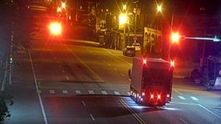

Renai Township lies in the Meixi River valley in Nantou County, where forested ridges rise from Wushe toward the high country around Hehuanshan. This central Taiwanese township is closely associated with the Seediq people and the 1930 Wushe Incident, an uprising against Japanese colonial rule. Cingjing Farm occupies slopes at about 1,750 metres and is known for its open grassland setting amid the mountains. Provincial Highway 14A continues through the township toward the alpine roads of Hehuanshan, linking the settled valley with one of Taiwan’s best-known high-mountain areas. Explore nearby webcam locations that provide complementary perspectives on Renai Township and Taiwan’s central mountains.
4 webcams
Nantou County stretches from the Puli Basin to the high ridges of the Central Mountain Range, encompassing inland basins, river valleys and heavily forested mountains. Taiwan’s only landlocked county lies at the centre of the island, where roads rise from towns and farmland toward some of its highest terrain. Sun Moon Lake, Taiwan’s largest lake, is Nantou’s best-known destination; its shores are also home to the Thao, one of Taiwan’s Indigenous peoples. Puli is associated with paper-making, while the county’s mountain areas include the extensive Yushan National Park. Move on to other webcams in the region to compare landscapes and settings around Nantou County.
5 webcams
Taiwan's terrain ranges from fertile plains along the western coast to steep mountains in the interior, concentrating much of its population on the lowlands. The Central Mountain Range runs through the island, while the Pacific meets a more rugged eastern shoreline and the Taiwan Strait lies to the west. Taipei combines contemporary city life with major cultural institutions: the National Palace Museum preserves an extensive collection of Chinese imperial art. Across Taiwan, night markets are central to everyday eating, serving regional snacks alongside familiar staples. Tea cultivation, especially in upland areas, remains an enduring part of the island's food culture. Explore nearby locations that provide complementary perspectives on Taiwan.
95 webcams