 Presidente Franco
 combines a low-rise, leafy urban character with the energy of a borderland city, reflecting its position at Paraguay’s far eastern edge. It stands on the Paraná River beside Ciudad del Este, close to the point where Paraguay, Brazil and Argentina meet; the Paraná and Iguazú rivers form this international frontier. The municipality’s leading natural landmark is Saltos del Monday, a group of waterfalls on the Monday River. Founded in 1929 as Puerto Presidente Franco, the city has developed through residential neighbourhoods, local commerce and riverfront terrain, providing a more relaxed urban counterpart to the larger Ciudad del Este conurbation.
Generated by AI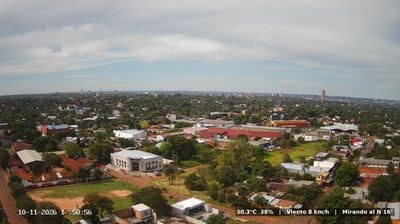
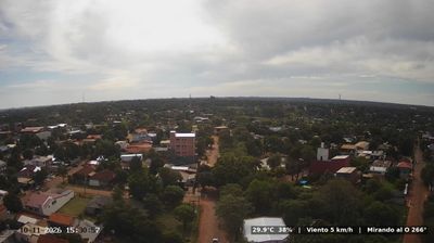




Tucked along the Paraná River in eastern Paraguay, Presidente Franco is a place whose character is shaped by its position near the meeting point of Paraguay, Brazil and Argentina. Immediately south of Ciudad del Este, it belongs to the urban area centred on one of Paraguay’s principal commercial cities, while the Paraná marks the country’s eastern border. The Monday River crosses the municipality on its way to the Paraná, and Saltos del Monday—an impressive series of waterfalls—is Presidente Franco’s best-known natural landmark. Paths and viewing areas around the falls make the force of the river a central part of a visit. Browse additional webcams from Alto Paraná to extend your view of eastern Paraguay.
3 webcams
Alto Paraná combines intense cross-border commerce with a predominantly subtropical agricultural interior in a way that reflects its position along the Paraná River on Paraguay’s eastern frontier. Ciudad del Este, the departmental capital, faces Brazil across the river and is linked to Foz do Iguaçu by the Friendship Bridge, making the international boundary part of everyday urban life. Farther north, the Itaipu Dam spans the Paraná between Paraguay and Brazil, and its reservoir has reshaped the river corridor. Soy and maize are major crops on the region’s red soils, while its towns reflect Paraguayan, Brazilian and wider immigrant influences. Browse other webcams across Paraguay’s eastern frontier to place Alto Paraná in a wider geographic context.
4 webcams
Organized around the Paraguay River system, Paraguay developed into a landlocked South American republic whose eastern and western regions have markedly different characters. East of the river, the more densely settled Región Oriental includes Asunción, the capital, and fertile farming country; to the west, the Gran Chaco extends across a broad, sparsely populated plain. The Paraná River marks much of the eastern frontier and powers the binational Itaipú Dam with Brazil. Spanish and Guaraní are both official languages, while tereré, a cold yerba mate infusion, is a familiar social ritual. The Jesuit Missions of La Santísima Trinidad de Paraná and Jesús de Tavarangue preserve a chapter of the colonial era. Place Paraguay in its South American setting by browsing webcams nearby.
6 webcams