 Paderborn: Stadtpark
Paderborn lies along the Pader River, where more than 200 springs rise in the city centre on the edge of the Paderborn Plateau. These sources form one of Germany’s shortest rivers: after roughly four kilometres, the Pader joins the Lippe. The city developed around the bishopric founded by Charlemagne in 799, and Paderborn Cathedral remains its central religious landmark, with much of its present structure dating from the 13th century. Medieval streets and red-tiled roofs meet post-war and contemporary development, reflecting a university city that is also a regional centre for eastern North Rhine-Westphalia. The nearby Teutoburg Forest adds a wooded counterpoint to the surrounding lowland.
Generated by AI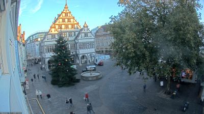

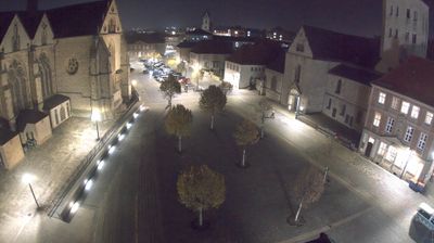




Tucked along the Pader springs in eastern North Rhine-Westphalia, Paderborn is a city whose character is shaped by water emerging beneath its historic centre. More than 200 springs feed the Pader, which runs for only about four kilometres before joining the Lippe in the Schloss Neuhaus district. Paderborn Cathedral, dedicated to Saints Mary, Liborius and Kilian, anchors the old town, with its western tower serving as a familiar landmark. The nearby Imperial Palace recalls the city’s Carolingian importance: Charlemagne held assemblies here in the late eighth century. University life, pedestrian streets, parks and spring-fed channels now share this compact urban setting. Find related webcams across the Paderborn area to build a fuller picture of eastern Westphalia.
8 webcams
Built around the Rhine trade corridor and the Ruhr coal-and-steel belt, North Rhine-Westphalia grew into Germany’s most populous state. The Rhine crosses its western side, linking Cologne, Düsseldorf and Bonn, while the Ruhr became one of Europe’s defining industrial regions. Dortmund, near these coordinates, reflects that legacy alongside a major football and brewing tradition. Cologne Cathedral, a UNESCO World Heritage site, remains the state’s best-known monument, and Essen’s Zollverein Coal Mine Industrial Complex records the scale of its mining past. Forested uplands in the Sauerland and Teutoburg Forest broaden a region often associated only with cities and factories. Explore additional webcams nearby to better understand how North Rhine-Westphalia connects the Rhine, the Ruhr and its surrounding uplands.
274 webcams
Germany stretches from the North Sea and Baltic Sea coasts to the Alps on its southern border, encompassing northern plains, river valleys and forested uplands. The Rhine, Danube and Elbe have long connected its regions, while the Black Forest and Bavarian Alps give the south a more dramatic relief. Berlin’s Brandenburg Gate and Museum Island reflect the capital’s role in German history and culture. Cologne Cathedral, a UNESCO World Heritage Site, rises above the Rhine, and the Bauhaus movement, founded in Weimar in 1919, transformed modern design far beyond Germany. Regional cooking, Christmas markets and brewing traditions bring further character to daily life. Browse additional webcams from the surrounding area to extend your view of Germany.
2.8K webcams