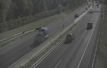
 Neudorf bei Parndorf: VK_A06_005,350-V0-FL
The landscape around Neudorf bei Parndorf is a broad, intensively cultivated expanse of the Pannonian Plain, which has shaped both the built environment and local life. Fields and wind turbines extend across the low terrain north of Lake Neusiedl, a shallow steppe lake shared by Austria and Hungary. The settlement stands beside the A4 Ost Autobahn, the principal eastbound route from Vienna towards the Hungarian border, making this a working transport corridor as well as a rural part of Burgenland. Wind power is a defining land use on the Parndorf Plain, whose wide horizon and sparse relief contrast with Austria’s Alpine regions. Burgenland became part of Austria in 1921, and its borderland position remains central to the identity of this eastern state.
Generated by AI




The landscape around Neudorf bei Parndorf is an open expanse of the Pannonian plain, whose level farmland and exposed conditions have shaped both the settlement pattern and local agricultural economy. This small municipality in northern Burgenland stands within the wider Lake Neusiedl region, not far from Austria’s borders with Hungary and Slovakia. Lake Neusiedl’s lowland is noted for vineyards, extensive reed beds and migratory birds, linking farming settlements with one of Central Europe’s distinctive steppe-lake environments. Neudorf belongs to Burgenland’s Croatian-speaking cultural area; its Croatian name, Novo Selo, records a minority heritage shared by several communities in the province. Explore nearby webcam locations for complementary perspectives on northern Burgenland and the Lake Neusiedl region.
1 webcam
Among Austria’s regions, Burgenland stands out for its Pannonian character, where vineyards, gentle hills and the reed-fringed Neusiedler See meet the Hungarian border. Austria’s easternmost state has a warmer, drier climate than much of the country, and winegrowing is central to its identity; Blaufränkisch is particularly associated with the Mittelburgenland area. The shallow lake and surrounding wetlands form part of the Fertő/Neusiedlersee Cultural Landscape, a UNESCO World Heritage site shared with Hungary. Eisenstadt, the state capital, is home to Esterházy Palace, closely linked to composer Joseph Haydn’s long service at the Esterházy court. Discover other points of interest through webcams located across Burgenland.
82 webcams
Austria stretches from the Bohemian Massif along its northern edge to the Carnic Alps on the Italian border, encompassing high Alpine ranges and the Danube lowlands. The Danube links cities including Linz and Vienna, while the Grossglockner, at 3,798 metres, is the country’s highest mountain. Vienna developed for centuries as the seat of the Habsburg court, leaving imperial architecture around the Hofburg and Schönbrunn Palace. Salzburg is closely associated with Wolfgang Amadeus Mozart, who was born there in 1756. Alpine Tyrol, wine-growing areas east of Vienna and the lakes of Salzkammergut add markedly different regional identities. Browse other webcams across Austria to place this setting in a wider geographic context.
2.6K webcams