 Mariquina: Aeródromo Pichoy
Aeródromo Pichoy sits in the lowlands around Mariquina in Chile’s Los Ríos Region, where airport infrastructure meets fields and wooded parcels. Also called Valdivia Airport, it is the commercial airport serving Valdivia, the regional capital, and connects this part of southern Chile with the national air network. Its largely rural site contrasts with Valdivia’s urban centre and makes it an arrival point for the river-and-wetland country around the city. Mariquina belongs to a temperate, water-rich landscape of farms, native forest and waterways. Valdivia also retains a strong German immigrant legacy from the 19th century, reflected in its food and brewing traditions.
Generated by AI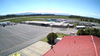

Mariquina has served as an agricultural centre in Chile’s Los Ríos Region since the nineteenth century. Known locally as San José de la Mariquina, it lies in southern Chile’s rainy lowlands, where pasture, farmland and native forest meet the basin of the Cruces River. The river crosses the commune on its way toward Valdivia and is associated downstream with the protected Río Cruces wetlands, an important habitat for waterbirds. Mariquina’s identity is shaped by farming and Mapuche presence in the surrounding territory, rather than the busier urban pace of Valdivia. Its location on Chile’s main north–south highway also places it between Valdivia and Temuco. Continue to other webcams in Los Ríos to compare river valleys and town settings around Mariquina.
2 webcams
Formed around the waterways of the Valdivia River basin, Los Ríos developed into one of southern Chile’s most water-defined regions. Its capital, Valdivia, was founded in 1552 and remains closely tied to the river, which reaches the Pacific through a network of estuaries. North of the city, the Río Cruces Nature Sanctuary protects extensive wetlands known for black-necked swans. Elsewhere, the region extends from temperate rainforests and Andean lakes to the coast, with Panguipulli an important lakeside centre. Nineteenth-century German settlement helped shape Valdivia’s brewing and culinary traditions. Trace Los Ríos within southern Chile by browsing webcams from nearby areas.
2 webcams
Among the countries of South America, Chile stands out for its exceptional north-to-south extent between the Andes and the Pacific Ocean. The Atacama Desert in the north is one of the driest places on Earth, while the south reaches into Patagonia, where Torres del Paine National Park is known for its jagged granite peaks, glaciers and lakes. Chile also includes Rapa Nui, the Pacific island famed for its monumental moai statues. In Valparaíso, steep hills, funicular railways and colourful historic neighbourhoods reflect the country’s maritime past; its historic quarter is a UNESCO World Heritage Site. Find related webcams in the surrounding area to build a fuller picture of Chile’s Pacific coast and Andean regions.
100 webcams