 Lungern: Obsee
Tucked between the steep slopes of central Switzerland, Lungern is a place whose character is shaped by Lake Lungern and the narrow Alpine valley around it. The village lies in Obwalden on the route over the Brünig Pass, linking central Switzerland with the Bernese Oberland. Pastures, farmhouses and compact residential areas occupy the limited level ground beside the lake, while forest rises over the surrounding mountainsides. Lake Lungern was substantially lowered during the 19th century to create farmland and today also supports hydropower generation. Its clear blue water, traditional chalet-style buildings and working agricultural land give Lungern a distinctly rural identity.
Generated by AI
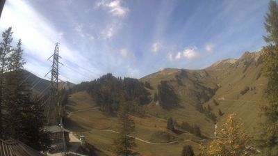






Lungern sits beside Lake Lungern in Obwalden, Switzerland, where a narrow Alpine valley climbs toward the Brünig Pass. The settlement occupies the lake’s eastern end, with steep mountain slopes and pastureland shaping a compact setting between central Switzerland and the Bernese Oberland. Lake Lungern is regulated for hydroelectric power, making its water both a regional landmark and part of the area’s working infrastructure. Lungern is also served by the Brünig railway route, which links Lucerne and Interlaken across the high pass. Browse additional webcams nearby to see how Lungern and the Brünig region connect to the surrounding Alps.
5 webcams
Built around the Sarner Aa valley, Obwalden developed into one of the small cantons of central Switzerland. Lake Sarnen and Lake Lungern shape its settled valleys, while the terrain climbs rapidly toward the Alps. Engelberg, in the canton’s south, is known for its Benedictine abbey, founded in 1120, and for access to Mount Titlis. The capital, Sarnen, keeps the administrative focus close to Lake Sarnen; elsewhere, farms, woodland and mountain pastures remain central to the local character. Obwalden also formed part of historic Unterwalden, one of the communities associated with the early Swiss Confederation. View additional webcams nearby to better understand how Obwalden connects with the lakes and high valleys of central Switzerland.
19 webcams
Switzerland stretches from the Jura Mountains in the northwest to the Alps in the south, encompassing a central plateau of cities, farms and lakes. The Rhine rises in the Swiss Alps, while Lake Geneva forms part of the country’s southwestern border. Zürich, Geneva and Basel are major urban centres, yet mountain railways and passes remain central to how many regions are experienced. Four national languages—German, French, Italian and Romansh—reflect Switzerland’s distinct cantonal identities. The Matterhorn above Zermatt is among Europe’s most recognisable peaks, and the 1291 Federal Charter is closely associated with the country’s founding tradition. Continue through nearby webcams to explore different parts of Switzerland.
1.5K webcams