 Loviisa: Tie 7 Markkinamäki, puomi, länsi - Tie 7 Kotkaan
The landscape around Loviisa is a low, forested Baltic coast of granite outcrops and sheltered inlets, which has shaped both the built environment and local life. On the Gulf of Finland, this eastern Uusimaa town developed around a harbour and the land route between Helsinki and the Russian border. Its 18th-century wooden old town retains a regular street grid, while the offshore Svartholm sea fortress was built as part of Sweden’s eastern defences. The E18, Finland’s principal east–west road towards the border, crosses the municipality through pine and mixed forest typical of this stretch of coast. Loviisa is also associated with the nuclear power plant on Hästholmen island.
Generated by AI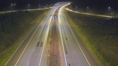






Tucked along the Gulf of Finland on Finland’s southern coast, Loviisa is a place whose character is shaped by a sheltered coastal archipelago and long maritime connections. The town was founded in 1745 as a border stronghold of the Swedish realm, and the sea fortress of Svartholm, begun in 1748 on an island outside the harbour, recalls that strategic role. Loviisa’s historic lower town preserves a grid of streets and wooden houses, while the waterfront ties daily life to the Baltic. Each August, Loviisa Historic Houses opens privately owned homes to the public, adding a living dimension to the town’s built heritage. View additional webcams nearby to better understand how Loviisa relates to the Gulf of Finland and its archipelago.
8 webcams
The terrain of Uusimaa ranges from a low, island-dotted coast in the south to wooded uplands and lake country in the north, binding Finland’s capital region to the Gulf of Finland. Helsinki, the national capital, is its urban centre, while the coast extends through the municipalities of Espoo and Porvoo. Suomenlinna, the sea fortress off Helsinki and a UNESCO World Heritage Site, recalls Sweden’s 18th-century rule; the medieval Porvoo Cathedral and old town add another historic strand. Inland, Nuuksio National Park protects a mosaic of forest, lakes and rocky terrain close to the metropolitan area. Explore additional nearby webcams to see how Uusimaa connects with the Gulf of Finland and southern Finland.
203 webcams
The terrain of Finland ranges from low coastal plains along the Gulf of Bothnia to fells in Lapland, creating a country of forests, lakes and long northern distances. More than 180,000 lakes shape everyday life, while the Lakeland region is threaded with waterways and islands. Helsinki, on the Gulf of Finland, combines neoclassical landmarks around Senate Square with contemporary Finnish design. Farther north, the Sámi are Finland’s only recognised Indigenous people, and their culture remains closely connected to the Arctic region. In winter, snow and ice transform the north; in summer, long daylight extends outdoor life well into the evening. Continue through nearby webcams to explore different parts of Finland.
1.7K webcams