 Le Lavandou: Cavalière vers le Layet
Le Lavandou occupies a Mediterranean coastal strip at the foot of the Massif des Maures in the Var department. The town extends between the sea and wooded hills, with beaches, small coves and headlands shaping this section of Provence’s coast. Offshore, the Îles d’Hyères include Porquerolles, Port-Cros and Île du Levant; Port-Cros National Park protects a large part of this island environment. Le Lavandou became an independent commune in 1913, separating from Bormes-les-Mimosas. It also lies on the Route du Mimosa, a coastal route associated with the flowering mimosa landscapes of southeastern France.
Generated by AI
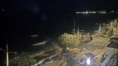






Built around a small fishing port on the Mediterranean, Le Lavandou grew into a seaside resort on the Côte d’Azur. The town stretches along the coast below the Massif des Maures and faces the Îles d’Hyères across the water. Its harbour remains a focal point for boats, cafés and the daily rhythm of the waterfront, while beaches and the coastal road trace the shore east and west of the centre. Le Lavandou became an independent commune in 1913, separating from Bormes-les-Mimosas. View additional webcams nearby to better understand how Le Lavandou’s Maures coastline relates to its Mediterranean surroundings.
14 webcams
Provence-Alpes-Côte d’Azur occupies France’s southeastern Mediterranean coast and Alpine borderlands. Its terrain runs from the Rhône delta and the Camargue wetlands to the limestone coves of the Calanques and the high valleys of the French Alps, while the Côte d’Azur forms its celebrated shoreline. Marseille, France’s oldest city, is a major port, and Avignon’s Palais des Papes recalls the 14th-century papal court. Inland, Provençal markets, olive cultivation and lavender-growing areas remain central to regional identity. Browse additional webcams nearby to see how Provence-Alpes-Côte d’Azur connects with the Mediterranean, the Alps and neighbouring Italy.
270 webcams
The Atlantic and Mediterranean coastlines, together with the Alps, Pyrenees and broad river basins, define much of France — they support maritime trade, farming, wine regions and travel throughout the year. The Seine runs through Paris, where the Eiffel Tower and the Louvre are among Europe’s most recognised landmarks. The Loire Valley is known for Renaissance châteaux, while Mont-Saint-Michel rises from a tidal bay in Normandy. Regional food traditions are equally distinctive, from Breton seafood to Provençal cooking, with bread, cheese and wine central to everyday life. France’s global cultural influence is evident in its language, literature, fashion and cinema. View additional webcams nearby to better understand how France’s coasts, plains and mountain borders relate to their surroundings.
2.2K webcams