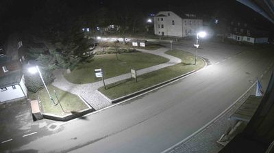
 Kvilda: Jezerní potok (pohled směr Horská)
Few places in the South Bohemian Region have a history as closely tied to Bohemian glassmaking as Kvilda. The settlement developed around glassworks in the 16th century and later became part of the high Šumava landscape shaped by forestry and mountain farming. At 1,065 metres, Kvilda is the highest municipality in Czechia. It lies within Šumava National Park, among spruce forests, open meadows and peatland country near the headwaters of the Vltava. The nearby Jezerní potok valley leads toward Horská Kvilda, another small settlement on the Šumava plateau. Kvilda remains a useful base for walking and cycling through this protected borderland, where the built fabric stays modest beside wide upland clearings.
Generated by AI





Few settlements in the Bohemian Forest have a history as closely linked to glassmaking as Kvilda. At 1,065 metres above sea level, it is among Czechia’s highest municipalities, set in the broad uplands of Šumava National Park. The Teplá Vltava rises nearby, beginning its course through peat bogs and spruce woods before joining the Vltava river system. Kvilda developed around an 18th-century glassworks, while forestry later shaped everyday life in this demanding mountain climate. Today, its position amid protected forests makes it a well-known starting point for walking and cycling across the Šumava highlands. Place Kvilda in its wider Šumava setting by browsing nearby webcams.
7 webcams
South Bohemian Region occupies a broad southern stretch of Bohemia in Czechia, reaching from the Šumava Mountains near Austria to the lowlands around České Budějovice. The Vltava flows north through this region, while the Třeboň area is renowned for its centuries-old network of fishponds and carp farming. Český Krumlov, set in a bend of the Vltava, is a UNESCO World Heritage Site known for its historic centre and castle complex. The regional capital, České Budějovice, is also home to the Budweiser Budvar brewery. Browse additional webcams from the surrounding area to extend your view of South Bohemia.
105 webcams
The terrain of Czechia ranges from fertile lowlands in southern Moravia to mountain ridges along the northern frontier, giving this Central European country a distinctly varied geography. The Vltava runs through Prague before joining the Elbe, while the Krkonoše form part of the border with Poland and include Sněžka, Czechia’s highest mountain. Prague’s historic centre, with Prague Castle and Charles Bridge, reflects the city’s long role as a political and cultural centre. Beyond the capital, Bohemia is known for spa towns and brewing, and Moravia for wine-growing traditions. View additional webcams nearby to better understand how Czechia relates to its Central European surroundings.
1.4K webcams