 Kurume
 occupies a broad alluvial plain along the Chikugo River in Fukuoka Prefecture, on northern Kyushu. At Komorino, Chitose Bridge carries National Route 3 over the river, placing this stretch within the principal road corridor linking Fukuoka Prefecture with southern Kyushu. The Chikugo is Kyushu’s longest river and has long shaped farming and settlement across its lowlands. Kurume is closely associated with Kurume kasuri, an indigo-dyed, resist-patterned cotton textile recognised as a traditional craft of Japan. Its urban districts, river embankments and productive plain give the city a more open, working character than the tightly built centres of larger Japanese cities. The river also frames the wider Chikugo area, where transport routes, agriculture and communities meet.
Generated by AI


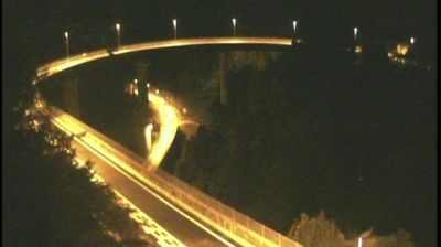

Built around Kurume Castle beside the Chikugo River, Kurume grew into an important city of southern Fukuoka Prefecture. The castle was the seat of the Arima clan during the Edo period; its remains occupy a riverside park, where stone walls and moats recall the former domain. Kurume is also associated with kasuri, an indigo-dyed resist-woven cotton textile, and with Kurume ramen, a local style of pork-bone noodle soup. The Ishibashi Cultural Center reflects the city’s link to Bridgestone founder Shōjirō Ishibashi, who was born here. Continue with other webcams from the area to see how this part of northern Kyushu connects regionally.
1 webcam
Fukuoka Prefecture runs from the Genkai Sea on Kyushu’s north coast to the Ariake Sea in the south, encompassing dense urban plains, island-dotted shores and wooded interior hills. It is a major centre of northern Kyushu: Fukuoka City developed around the old merchant port of Hakata, while Kitakyushu stands by the Kanmon Strait between Kyushu and Honshu. The Chikugo River reaches the Ariake Sea through the prefecture’s south, and the Itoshima coast opens west of the city. Dazaifu Tenmangu, dedicated to the scholar and statesman Sugawara no Michizane, reflects the area’s long political and religious importance. Move on to other webcams in the region to compare landscapes and settings around Fukuoka Prefecture.
20 webcams
Among the countries of East Asia, Japan stands out for its volcanic archipelago, stretching from the cool north of Hokkaido to subtropical Okinawa. Mount Fuji, the nation’s highest mountain, rises above central Honshu, while the Pacific Ocean and the Seto Inland Sea have long shaped settlement, fishing and travel. Tokyo pairs dense urban life with major museums and neighbourhood traditions; Kyoto preserves temples, gardens and the legacy of Japan’s imperial court. Seasonal customs give journeys a changing rhythm, from spring cherry blossom viewing to autumn leaves. Regional cooking is equally varied, with sushi, ramen and local specialties reflecting coastlines, climate and agriculture. Explore nearby webcam locations that provide complementary perspectives on Japan’s islands, cities and mountain regions.
1.3K webcams