 Klausen-Leopoldsdorf: VK_A21_005,400-F1-FL
Among the places of Lower Austria, Gemeinde Klausen-Leopoldsdorf stands out for the A21 Vienna Outer Ring Motorway running through the wooded Wienerwald. This dispersed municipality lies southwest of Vienna, within the Vienna Woods, an extensive upland belt of forest marking the transition between the capital’s outskirts and rural Lower Austria. The A21 is an important part of Austria’s motorway network: it links the A1 West Motorway at Steinhäusl with the A2 South Motorway near Vösendorf, bypassing Vienna to the west and south. Klausen-Leopoldsdorf is therefore shaped by both forest roads and long-distance traffic. The Wienerwald has long served as a recreational landscape for Vienna, with walking and cycling routes extending through its woodland.
Generated by AI

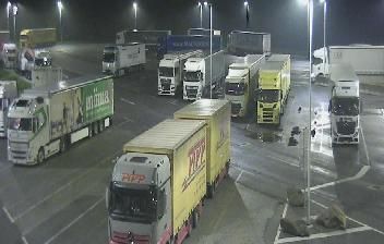

Few communities in Lower Austria have a history as closely tied to forestry in the Vienna Woods as Gemeinde Klausen-Leopoldsdorf. Set in the forested Triesting valley southwest of Vienna, the municipality belongs to the UNESCO Wienerwald Biosphere Reserve, where managed woodland, meadows and small settlements form a lived-in cultural landscape. The Triesting gives the area a clear valley axis, while the surrounding hills keep the setting markedly rural despite the proximity of the capital. Forestry remains an important part of local identity, reflecting the long practical relationship between these communities and the woods. Discover other points of interest through webcams located across Lower Austria and the Vienna Woods.
4 webcams
Lower Austria is best known within Austria for the Wachau, the UNESCO World Heritage cultural landscape along the Danube. Austria’s largest federal state extends from the Bohemian Massif in the north to the limestone Alps around Rax and Schneeberg in the south, with vineyards, forests and agricultural districts between them. St. Pölten is the provincial capital, while Melk Abbey rises above the Danube as one of the country’s foremost Baroque monuments. Vienna is a separate federal state, though it is enclosed by Lower Austria. Explore nearby webcam locations that provide complementary perspectives on the Wachau and Lower Austria.
397 webcams
Austria stretches from the Bohemian Massif along its northern edge to the Carnic Alps on the Italian border, encompassing high Alpine ranges and the Danube lowlands. The Danube links cities including Linz and Vienna, while the Grossglockner, at 3,798 metres, is the country’s highest mountain. Vienna developed for centuries as the seat of the Habsburg court, leaving imperial architecture around the Hofburg and Schönbrunn Palace. Salzburg is closely associated with Wolfgang Amadeus Mozart, who was born there in 1756. Alpine Tyrol, wine-growing areas east of Vienna and the lakes of Salzkammergut add markedly different regional identities. Browse other webcams across Austria to place this setting in a wider geographic context.
2.2K webcams